Map of Stewart Island New Zealand, November 1898, additions to 1917, 1918
Component — map-box: 1
Identifier: S00100001_e
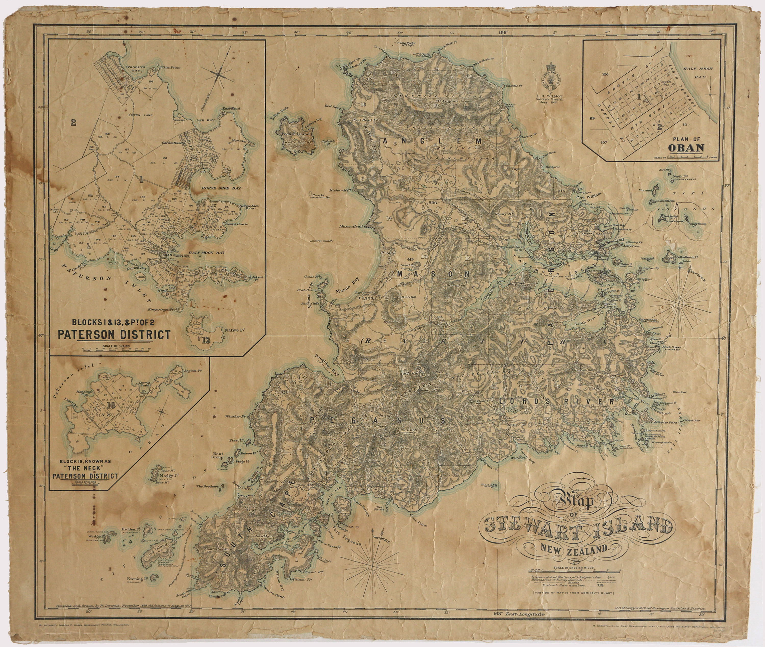
Map of Stewart Island New Zealand
Scope and Contents
Map of Stewart Island New Zealand containing insets of Oban and Paterson District.
Dates
- November 1898, additions to 1917
- Publication: 1918
Creator
- New Zealand. Department of Lands and Survey (Publisher, Organization)
Conditions Governing Use
This item has no known copyright restrictions. Please reference Invercargill City Libraries and Archives A0001_S00100001_e when re-using this image.
Extent
From the Series: 33 maps/plans (Map-Boxes 1 - 8 and Drawer West 6 d)
Language of Materials
From the Item: English
Existence and Location of Copies
To obtain a high resolution copy of this image please contact the Archive.
Physical Description
Paper on linen.
Dimensions
H 615 mm x W 720mm
Content Notes
H.D.M. Haszard, Chief Surveyor, Southland District. M. Crompton-Smith, Chief Draughtsman, Head Office lands and Survey Department Wellington.
Inset map Plan of Oban, Blocks 1& 13, & Pt of 2 Paterson Inlet, Block 16, known as "The Neck" Paterson District. Pastoral Runs 536, 419, 422 & 533.(538 and 196?)
Inset map Plan of Oban, Blocks 1& 13, & Pt of 2 Paterson Inlet, Block 16, known as "The Neck" Paterson District. Pastoral Runs 536, 419, 422 & 533.(538 and 196?)
Creator
- New Zealand. Department of Lands and Survey (Publisher, Organization)
- Deverell, W. (Cartographer, Person)
Repository Details
Part of the Invercargill City Council Archives Repository
Contact:
50 Dee Street
Private Bag 90111
Invercargill Southland 9810 New Zealand
archives@icc.govt.nz
50 Dee Street
Private Bag 90111
Invercargill Southland 9810 New Zealand
archives@icc.govt.nz
