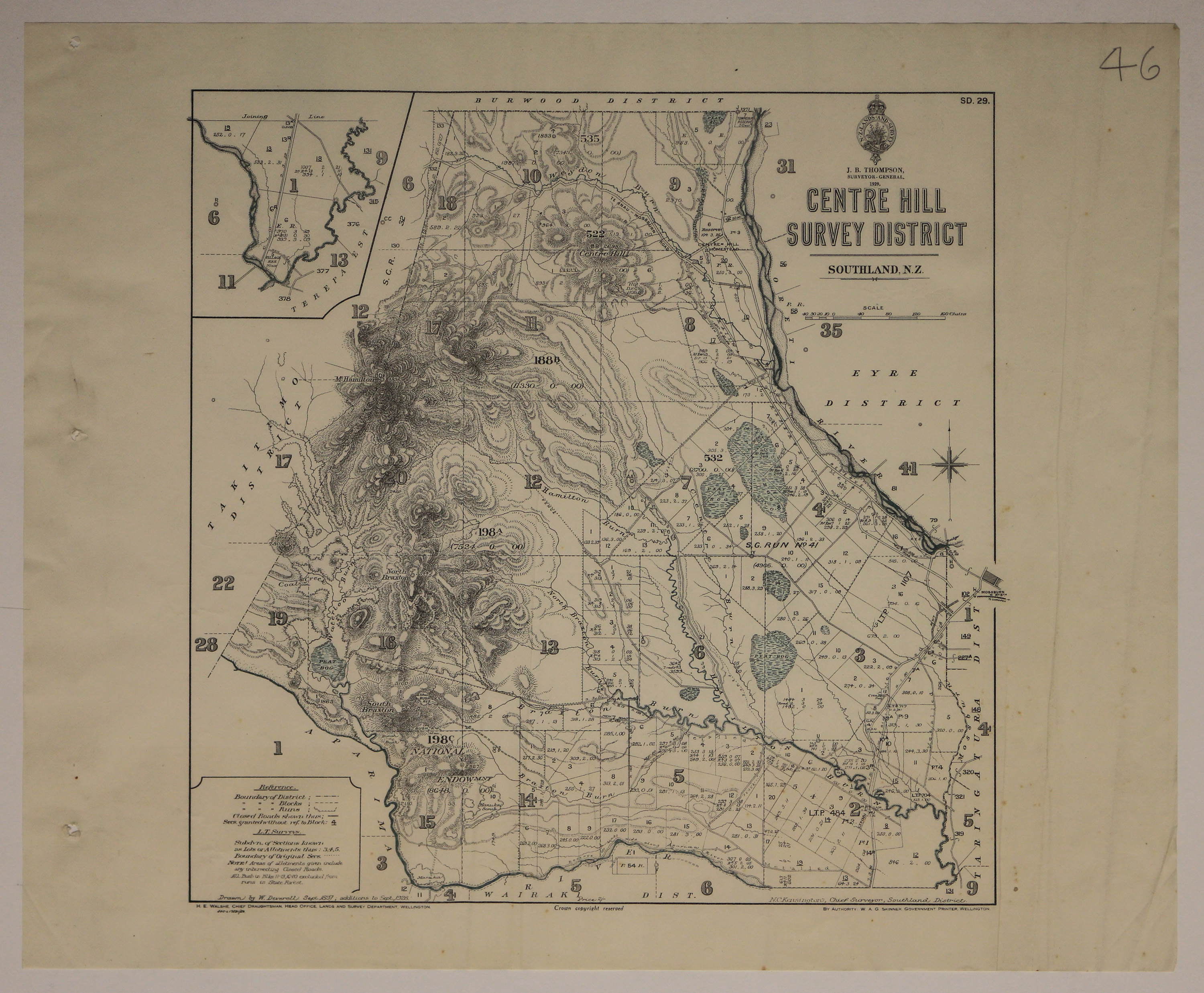
Centre Hill Survey District, Sept. 1897, additions to Sept. 1928., 1929
Component — map-box: 7
Identifier: S00100002_bb
Centre Hill Survey District
Scope and Contents
From the Item:
This item contains 85 individual maps.
Dates
- Sept. 1897, additions to Sept. 1928.
- Publication: 1929
Creator
- Deverell, W. (Draftsman, Person)
Conditions Governing Use
This item has no known copyright restrictions. Please reference Invercargill City Libraries and Archives A0001 S00100002_bb when re-using this image.
Extent
From the Series: 33 maps/plans (Map-Boxes 1 - 8 and Drawer West 6 d)
Language of Materials
From the Item: English
Existence and Location of Copies
To obtain a high resolution copy of this image please contact the Archive.
Physical Description
Paper.
Dimensions
H 430mm x W 490mm
Map Notes
Official Seal of NZ Lands & Survey. J B Thompson, Surveyor General. 1929.
Drawn by W Deverell Sep 1897, additions to Sep 1928.
H E Walshe, Chief Draughtsman.
N C Kensington, Chief Surveyor, Southland.
W A G Skinner, Government Printer.
Bordered by Takitimo, Wairaki, Taringatura, Eyre and Burwood Districts. Inset of Block I, Terepa Estate. Peat Bogs coloured in blue.
SD.29.
Creator
- Deverell, W. (Draftsman, Person)
- New Zealand. Department of Lands and Survey (Publisher, Organization)
Repository Details
Part of the Invercargill City Council Archives Repository
Contact:
50 Dee Street
Private Bag 90111
Invercargill Southland 9810 New Zealand
archives@icc.govt.nz
50 Dee Street
Private Bag 90111
Invercargill Southland 9810 New Zealand
archives@icc.govt.nz
