Reconnaissance Survey, 1857 [hand-drawn copy, Western Southland]
Digital Image
Identifier: D00100002_ad
Untitled
Dates
- No Date
Summary
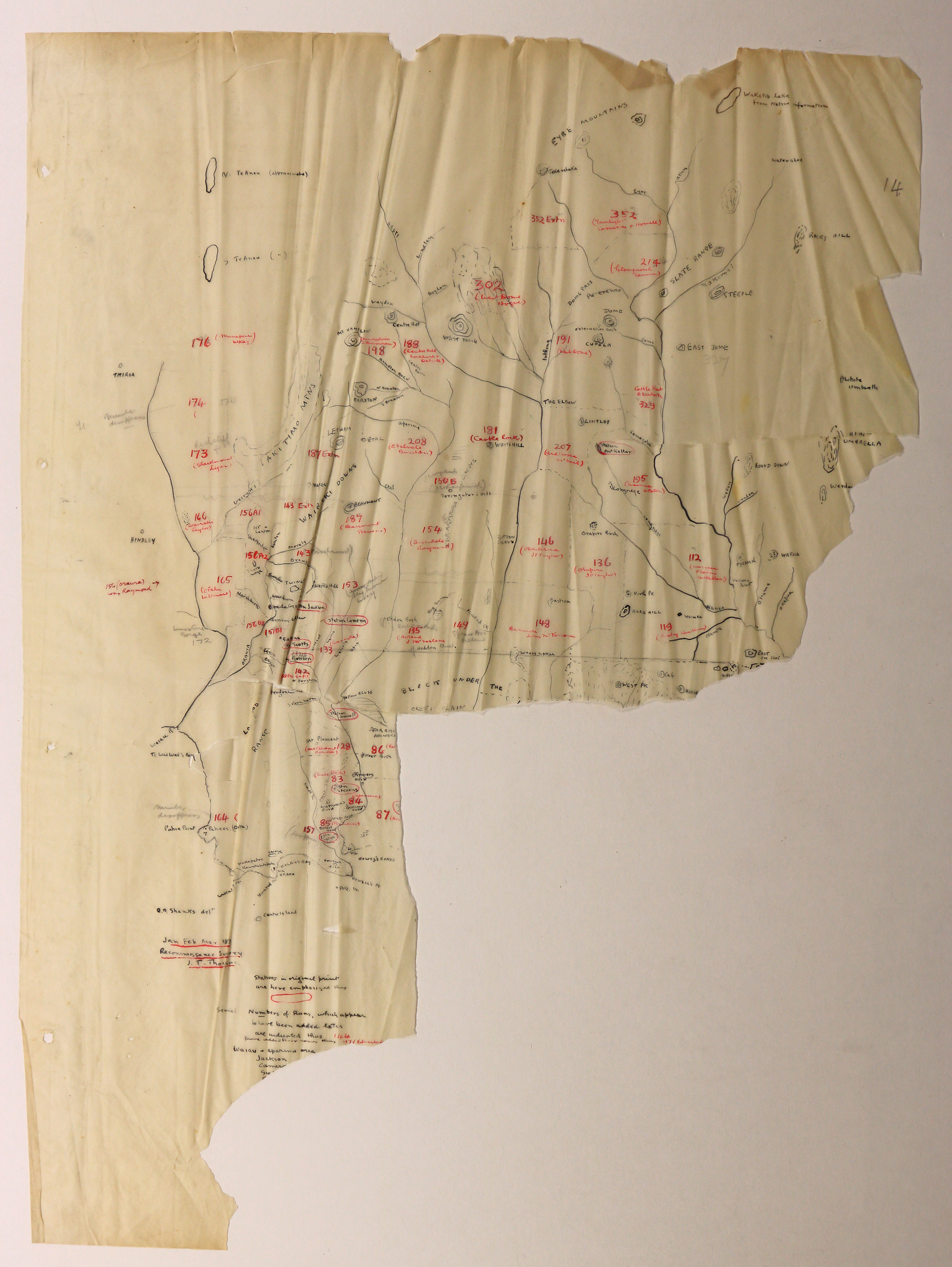
Hand drawn map with notations. Presumed to be by F.G. Hall-Jones, based on the map Reconnaissance Survey of Part of Otago Province - executed during the months of January, February and March by J T Thomson [John Turnbull Thomson], Chief Surveyor, 1857.
Covers from Riverton up to the Eyre Mountains, with Stations and Runs indicated in red ink.
Covers from Riverton up to the Eyre Mountains, with Stations and Runs indicated in red ink.
Conditions Governing Use
This item has no known copyright restrictions. Please acknowledge Invercargill City Libraries and Archives, Ref: A0001 S00100002_ad, when re-using this image.
Language of Materials
English
Existence and Location of Copies
To obtain a high resolution copy of this image please contact the Archive.
Physical Description
Waxed paper. Large portion missing. Very brittle and fragile.
Dimensions
H 730mm x W 510mm
Repository Details
Part of the Invercargill City Council Archives Repository
Contact:
50 Dee Street
Private Bag 90111
Invercargill Southland 9810 New Zealand
archives@icc.govt.nz
50 Dee Street
Private Bag 90111
Invercargill Southland 9810 New Zealand
archives@icc.govt.nz
