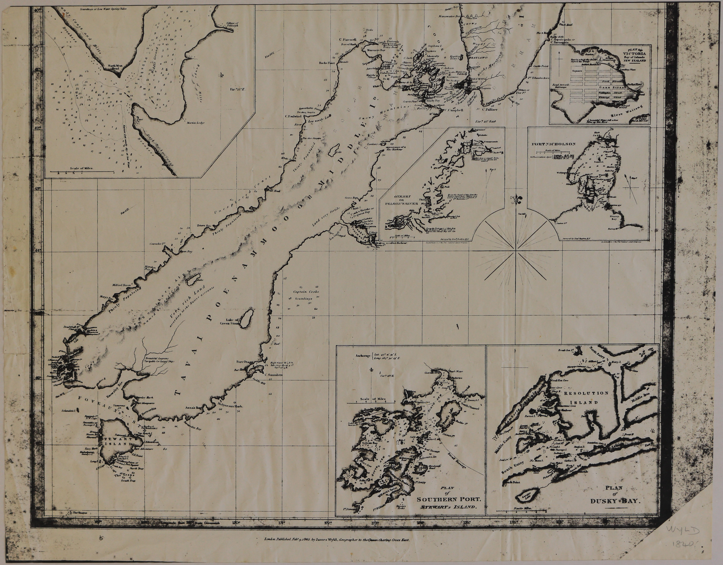
Portion of James Wyld's Chart of New Zealand [copy]
Digital Image
Identifier: D00100001_g
Untitled
Dates
- 1840
Creator
- Wyld, James (Person)
Summary
Incomplete copy of map showing Tawai Poenammoo or Middle Island with inset maps: Plan of Victoria, Bay of Islands; Port Nicholson; Oyerri or Pelorus River; Plan of Dusky Bay; Plan of Southern Port, Stewart's Island.
Conditions Governing Use
This item has no known copyright restrictions. Please reference Invercargill City Libraries and Archives A0001 S00100001_g when re-using this image.
Existence and Location of Copies
To obtain a high resolution copy of this image please contact the Archive.
Physical Description
Copy on paper.
Dimensions
H 472 mm x W 613mm
Map Notes
London. Published Feb 1840 by James Wyld, Geographer to the Queen, Charing Cross East.
Creator
- Wyld, James (Person)
Repository Details
Part of the Invercargill City Libraries and Archives Repository
