Black Hill, Burwood and Lincoln Survey Districts, 1913, 1920
Component — map-box: 7
Identifier: S00100002_ax
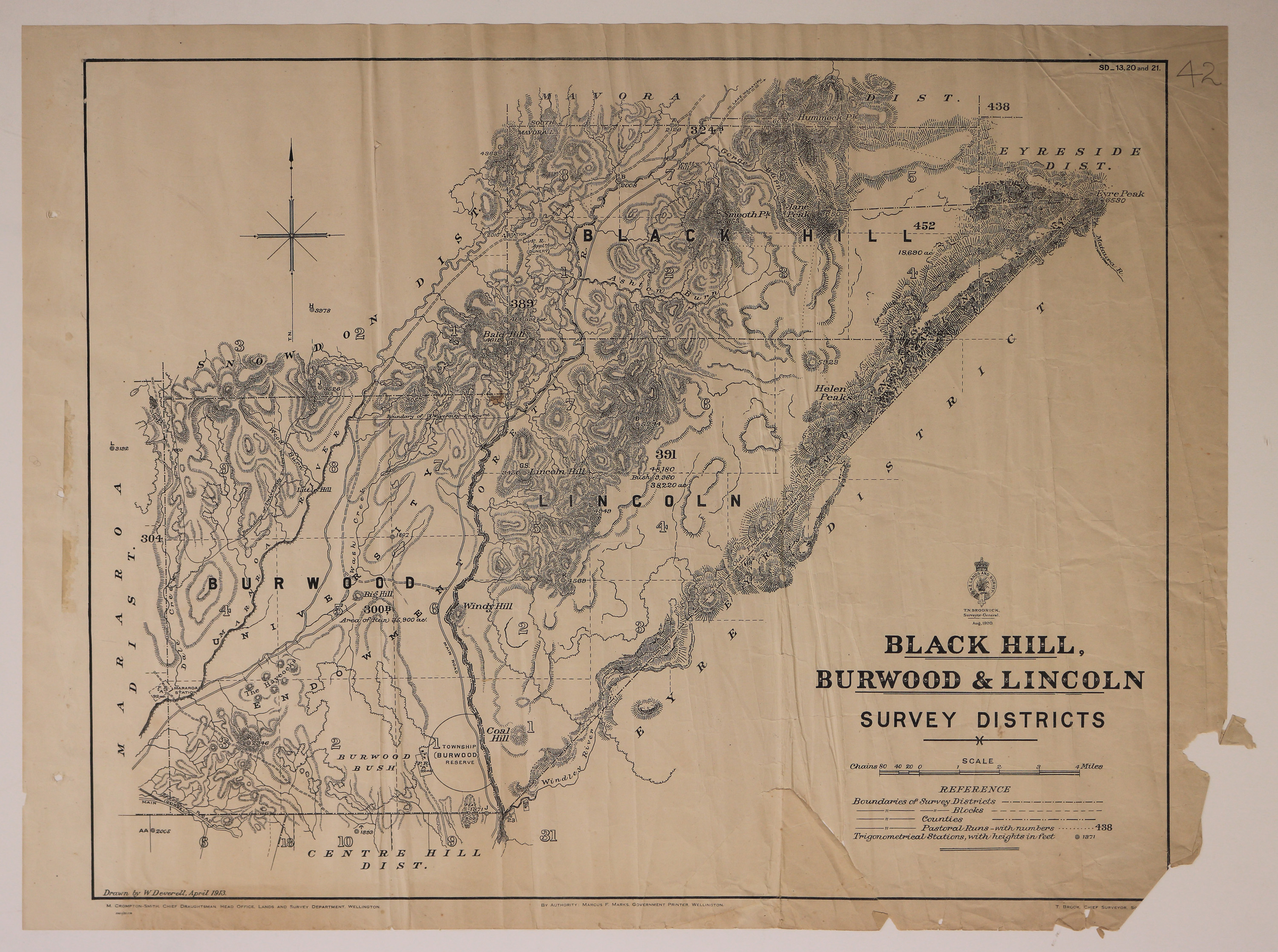
Black Hill, Burwood and Lincoln Survey Districts
Scope and Contents
Map of Black Hill, Burwood and Lincoln Survey Districts, including Pastoral Runs.
Dates
- 1913
- Publication: 1920
Creator
- New Zealand. Department of Lands and Survey (Publisher, Organization)
Conditions Governing Use
This item has no known copyright restrictions. Please reference Invercargill City Libraries and Archives A0001 S00100002_ax when re-using this image.
Extent
From the Series: 33 maps/plans (Map-Boxes 1 - 8 and Drawer West 6 d)
Language of Materials
From the Item: English
Existence and Location of Copies
To obtain a high resolution copy of this image please contact the Archive.
Physical Description
Paper.
Dimensions
H 570mm x W 670mm
Content Notes
Official Seal of NZ Lands & Survey, T N Brodrick, Surveyor General. 1920.
Drawn by W Deverell, April 1913.
M Crompton-Smith, Chief Draughtsman, Wellington. Marcus F Marks, Government Printer. T Brook, Chief Surveyor, Southland.
Includes: Centre Hill, Eyre, Eyreside, Mavora, Snowdon and Mararoa Districts.
SD_13, 20 and 21.
Number 42 in pencil top right corner.
Drawn by W Deverell, April 1913.
M Crompton-Smith, Chief Draughtsman, Wellington. Marcus F Marks, Government Printer. T Brook, Chief Surveyor, Southland.
Includes: Centre Hill, Eyre, Eyreside, Mavora, Snowdon and Mararoa Districts.
SD_13, 20 and 21.
Number 42 in pencil top right corner.
Creator
- New Zealand. Department of Lands and Survey (Publisher, Organization)
- Deverell, W. (Draftsman, Person)
Repository Details
Part of the Invercargill City Council Archives Repository
Contact:
50 Dee Street
Private Bag 90111
Invercargill Southland 9810 New Zealand
archives@icc.govt.nz
50 Dee Street
Private Bag 90111
Invercargill Southland 9810 New Zealand
archives@icc.govt.nz
