Caples Survey District, Revised, September 1921, 1922
Component — map-box: 7
Identifier: S00100002_az
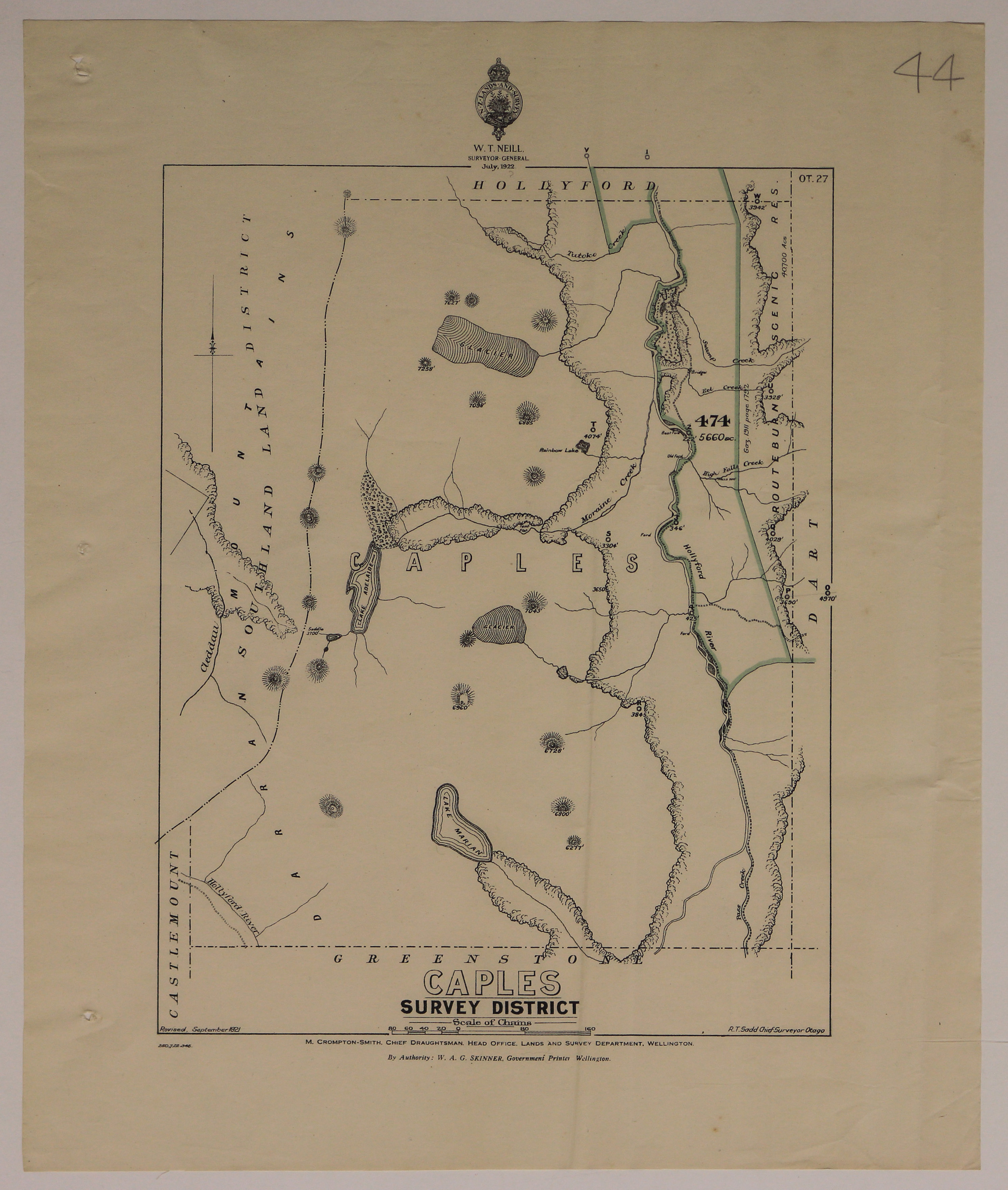
Caples Survey District
Scope and Contents
From the Item:
This item contains 85 individual maps.
Dates
- Revised, September 1921
- Publication: 1922
Creator
- New Zealand. Department of Lands and Survey (Publisher, Organization)
Conditions Governing Use
This item has no known copyright restrictions. Please reference Invercargill City Libraries and Archives A0001 S00100002_az when re-using this image.
Extent
From the Series: 33 maps/plans (Map-Boxes 1 - 8 and Drawer West 6 d)
Language of Materials
From the Item: English
Existence and Location of Copies
To obtain a high resolution copy of this image please contact the Archive.
Physical Description
Paper.
Dimensions
H 435mm x W 320mm
Content Notes
Official Seal of NZ Lands & Survey. W T Neill, Chief Surveyor. 1922.
M Crompton-Smith, Chief Draughtsman. Head Office, Lamds and Survey Department, Wellington.
R T Sadd, Chief Surveyor, Otago.
W A G Skinner, Government Printer.
Bounded by Castlemount, Greenstone, Dart, Hollyford. Area 474 outlined in green.
OT.27
Number 44 in pencil top right corner.
M Crompton-Smith, Chief Draughtsman. Head Office, Lamds and Survey Department, Wellington.
R T Sadd, Chief Surveyor, Otago.
W A G Skinner, Government Printer.
Bounded by Castlemount, Greenstone, Dart, Hollyford. Area 474 outlined in green.
OT.27
Number 44 in pencil top right corner.
Creator
- New Zealand. Department of Lands and Survey (Publisher, Organization)
Repository Details
Part of the Invercargill City Council Archives Repository
Contact:
50 Dee Street
Private Bag 90111
Invercargill Southland 9810 New Zealand
archives@icc.govt.nz
50 Dee Street
Private Bag 90111
Invercargill Southland 9810 New Zealand
archives@icc.govt.nz
