Cleughearn and Monowai, Sept. 1925, 1926
Component — map-box: 7
Identifier: S00100002_bd
Cleughearn and Monowai
Scope and Contents
From the Item:
This item contains 85 individual maps.
Dates
- Sept. 1925
- Publication: 1926
Creator
- Stewart, F. (Draftsman, Person)
Conditions Governing Use
This item has no known copyright restrictions. Please reference Invercargill City Libraries and Archives A0001 S00100002_bd when re-using this image.
Extent
From the Series: 33 maps/plans (Map-Boxes 1 - 8 and Drawer West 6 d)
Language of Materials
From the Item: English
Existence and Location of Copies
To obtain a high resolution copy of this image please contact the Archive.
Physical Description
Paper.
Dimensions
H 430mm x W 600mm
Content Notes
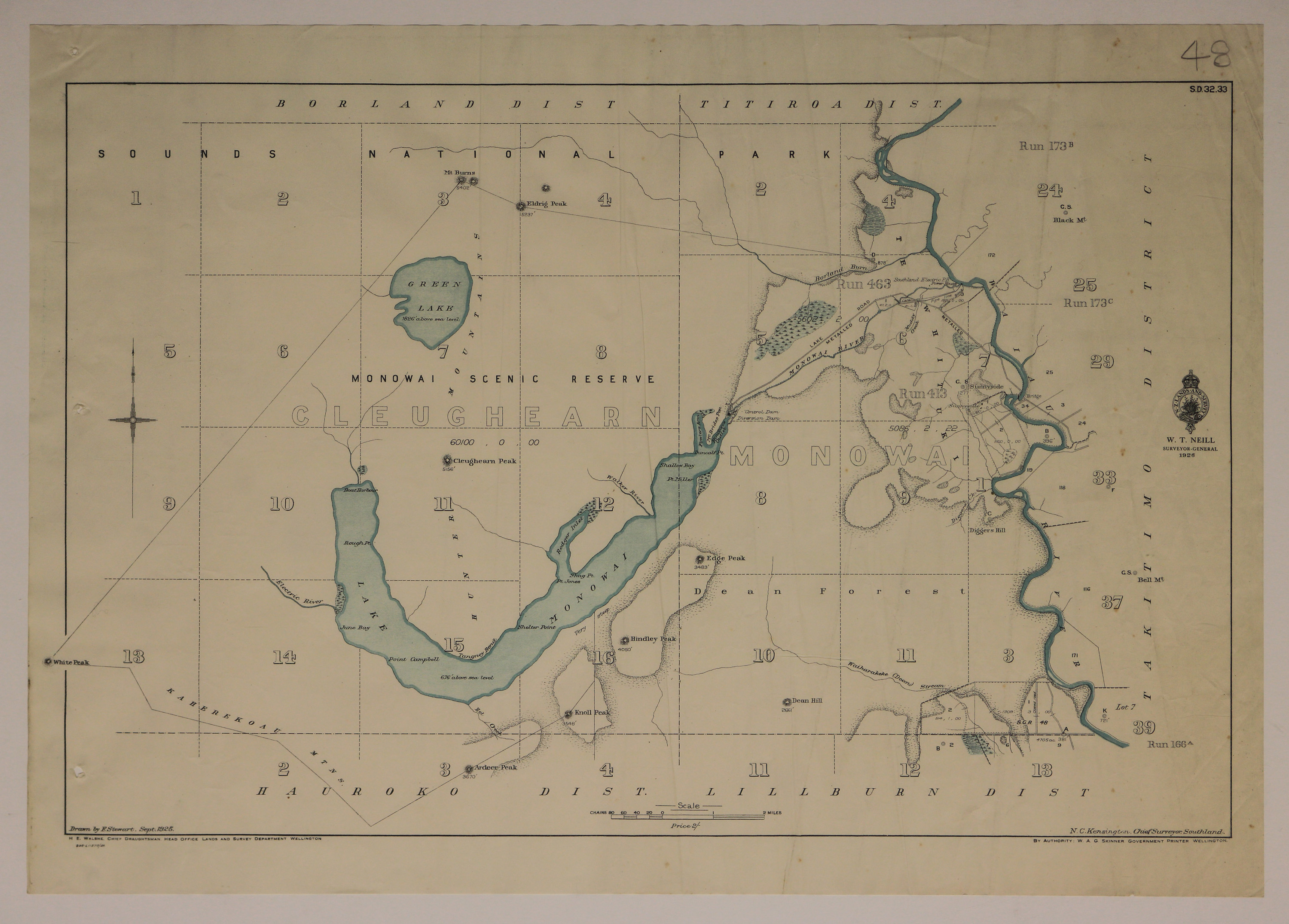
Official Seal of NZ Lands & Survey. W T Neill, Surveyor General. 1926.
Drawn by F Stewart 1925. H E Walshe, Chief Draughtsman. N C Kensington, Chief Surveyor, Southland. W A G Skinner, Government Printer.
Bounded by Hauroko, Lillburn, Takitimo, Borland and Titiroa Districts.
Featuring: Lake Monowai, Green Lake, Waiau River, Monowai Scenic Reserve, Block and Run numbers.
S.D. 32.33
Creator
- Stewart, F. (Draftsman, Person)
- New Zealand. Department of Lands and Survey (Publisher, Organization)
Repository Details
Part of the Invercargill City Council Archives Repository
Contact:
50 Dee Street
Private Bag 90111
Invercargill Southland 9810 New Zealand
archives@icc.govt.nz
50 Dee Street
Private Bag 90111
Invercargill Southland 9810 New Zealand
archives@icc.govt.nz
