Mabel Hundred, 1917, 1923
Component — map-box: 7
Identifier: S00100002_bx
Mabel Hundred
Scope and Contents
From the Item:
This item contains 85 individual maps.
Dates
- 1917
- Publication: 1923
Creator
- New Zealand. Department of Lands and Survey (Publisher, Organization)
Conditions Governing Use
This item has no known copyright restrictions. Please reference Invercargill City Libraries and Archives A0001 S00100002_bx when re-using this image.
Extent
From the Series: 33 maps/plans (Map-Boxes 1 - 8 and Drawer West 6 d)
Language of Materials
From the Item: English
Existence and Location of Copies
To obtain a high resolution copy of this image please contact the Archive.
Physical Description
Paper.
Dimensions
H 520mm x W 435mm
Content Notes
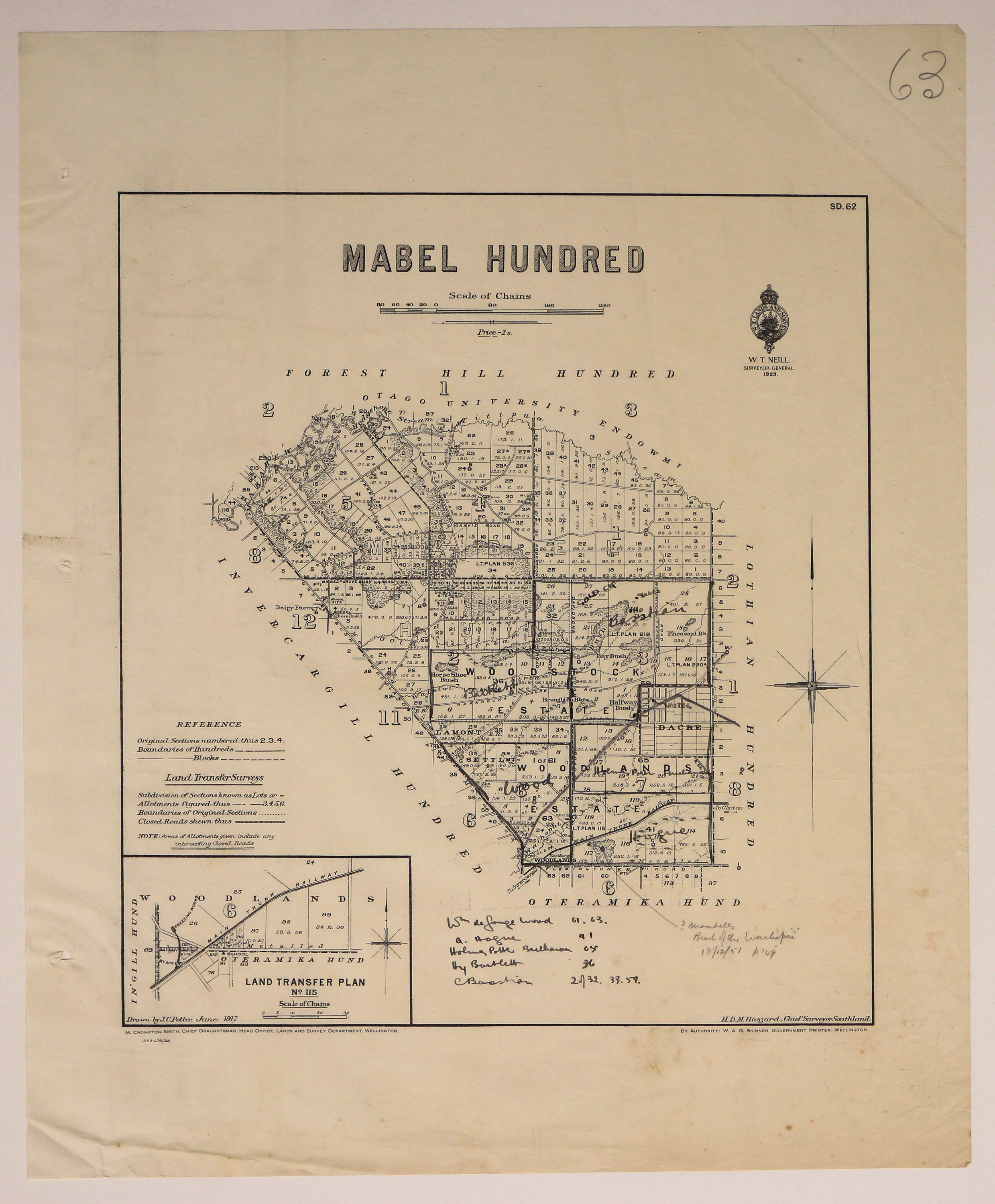
Official Seal of NZ Lands & Survey. W T Neill, Surveyor General.
H.D.M. Haszard, Chief Surveyor, Otago. M Crompton-Smith, Chief Draughtsman. W A G Skinner, Government Printer.
Bounded by Invercargill, Oteramika, Lothian, and Forest Hill Hundreds.
Woodstock & Woodlands Estates. Lamont Settlement. Dacre. Inset of Land transfer plan No 115, Woodlands.
Notes handwritten in ink, including names. One says Hotel [at Dacre].
S.D. 62
Creator
- New Zealand. Department of Lands and Survey (Publisher, Organization)
- Potter, J.C. (James Cleghorn) (Draftsman, Person)
Repository Details
Part of the Invercargill City Council Archives Repository
Contact:
50 Dee Street
Private Bag 90111
Invercargill Southland 9810 New Zealand
archives@icc.govt.nz
50 Dee Street
Private Bag 90111
Invercargill Southland 9810 New Zealand
archives@icc.govt.nz
