Map of Aparima, Oreti and part of Jacobs River Hundred, July 1896, additions to October 1920, 1925
Component — map-box: 7
Identifier: S00100002_av
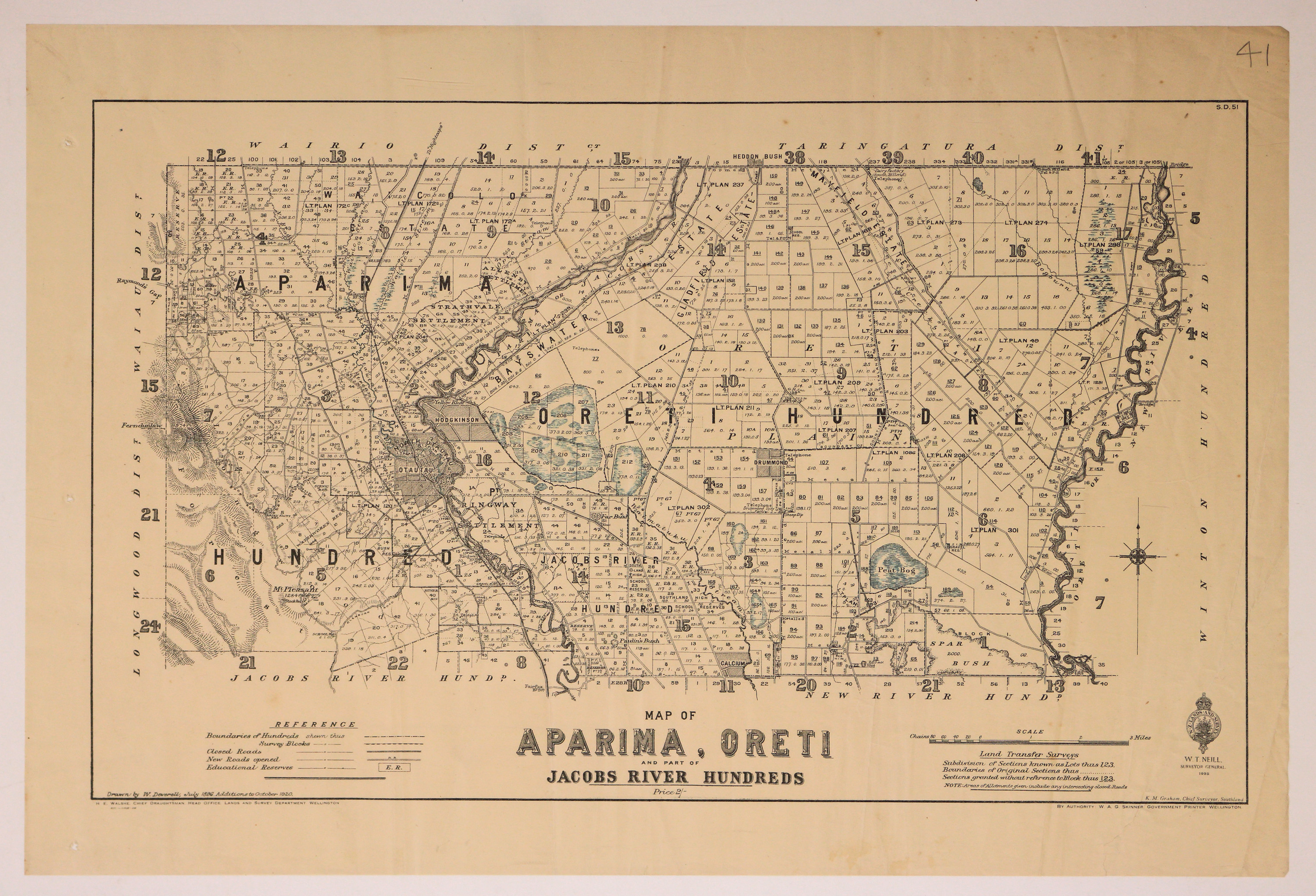
Map of Aparima, Oreti and part of Jacobs River Hundred
Scope and Contents
Map of the Aparima, Oreti Hundreds, with part of Jacob's River Hundred.
Dates
- July 1896, additions to October 1920
- Publication: 1925
Creator
- New Zealand. Department of Lands and Survey (Publisher, Organization)
Conditions Governing Use
This item has no known copyright restrictions. Please reference Invercargill City Libraries and Archives A0001_S00100002_av when re-using this image.
Extent
From the Series: 33 maps/plans (Map-Boxes 1 - 8 and Drawer West 6 d)
Language of Materials
From the Item: English
Existence and Location of Copies
To obtain a high resolution copy of this image please contact the Archive.
Physical Description
Paper.
Dimensions
H 432mm x W 600mm
Content Notes
Official Seal of NZ Lands & Survey. W T Neill, Surveyor General, 1925
Drawn by W Deverell, Jul 1869. additions to October 1920.
H E Walshe, Chief Draughtsman, Wellington. K M Graham, Chief Surveyor, Invercargill.
W A G Skinner, Government Printer.
S.D.51
Bordered by: Wairio, Taringatura, Longwood and Waiau Districts.
Bogs marked in blue pencil.
Drawn by W Deverell, Jul 1869. additions to October 1920.
H E Walshe, Chief Draughtsman, Wellington. K M Graham, Chief Surveyor, Invercargill.
W A G Skinner, Government Printer.
S.D.51
Bordered by: Wairio, Taringatura, Longwood and Waiau Districts.
Bogs marked in blue pencil.
Creator
- New Zealand. Department of Lands and Survey (Publisher, Organization)
- Deverell, W. (Draftsman, Person)
Repository Details
Part of the Invercargill City Council Archives Repository
Contact:
50 Dee Street
Private Bag 90111
Invercargill Southland 9810 New Zealand
archives@icc.govt.nz
50 Dee Street
Private Bag 90111
Invercargill Southland 9810 New Zealand
archives@icc.govt.nz
