Map of Part of North, Central and South Otago New Zealand, 1915, 1924
Component — map-box: 7
Identifier: S00100002_at
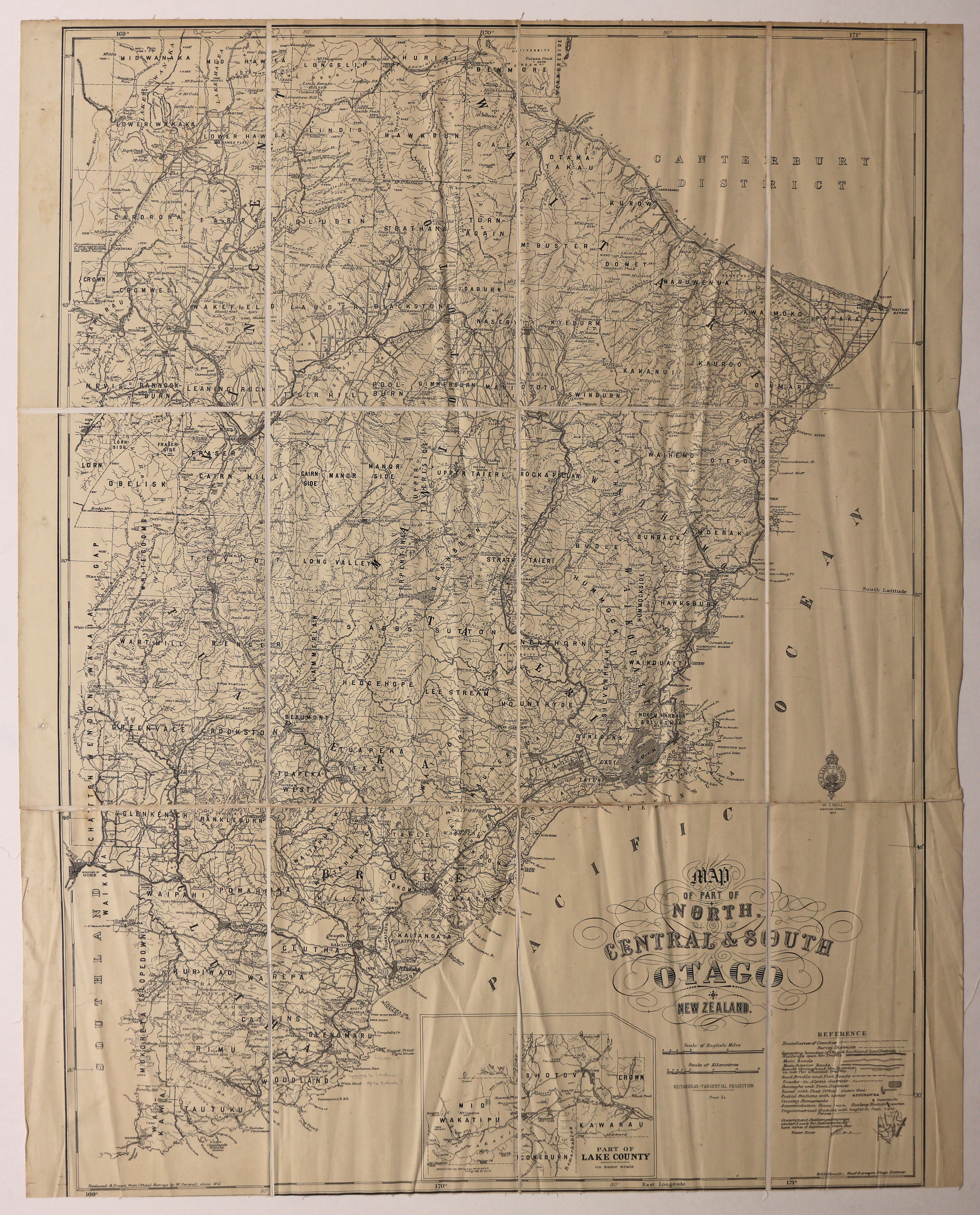
Map of part of North, Central and South Otago New Zealand
Scope and Contents
Map of Counties and Survey Districts, Otago. Reduced and Drawn from Official Surveys.
Dates
- 1915
- Publication: 1924
Creator
- New Zealand. Department of Lands and Survey (Publisher, Organization)
Conditions Governing Use
This item has no known copyright restrictions. Please reference Invercargill City Libraries and Archives A0001_S00100002_at when re-using this image.
Extent
From the Series: 33 maps/plans (Map-Boxes 1 - 8 and Drawer West 6 d)
Language of Materials
From the Item: English
Existence and Location of Copies
To obtain a high resolution copy of this image please contact the Archive.
Physical Description
Fabric backed paper.
Dimensions
H 1030mm x W 800mm
Content Notes
Official Seal of NZ Lands & Survey. W T Neill, Surveyor General, 1924.
Reduced and Drawn from Official Surveys by W. Deverall, June 1915.
R S Galbraith, Chief Surveyor, Otago.
Inset showing part of Lake County.
Reduced and Drawn from Official Surveys by W. Deverall, June 1915.
R S Galbraith, Chief Surveyor, Otago.
Inset showing part of Lake County.
Creator
- New Zealand. Department of Lands and Survey (Publisher, Organization)
- Deverell, W. (Draftsman, Person)
Repository Details
Part of the Invercargill City Council Archives Repository
Contact:
50 Dee Street
Private Bag 90111
Invercargill Southland 9810 New Zealand
archives@icc.govt.nz
50 Dee Street
Private Bag 90111
Invercargill Southland 9810 New Zealand
archives@icc.govt.nz
