Map of the Counties of Southland and Wallace and part of Lake County New Zealand, 1936, 1937
Component — map-box: 7
Identifier: S00100002_ar
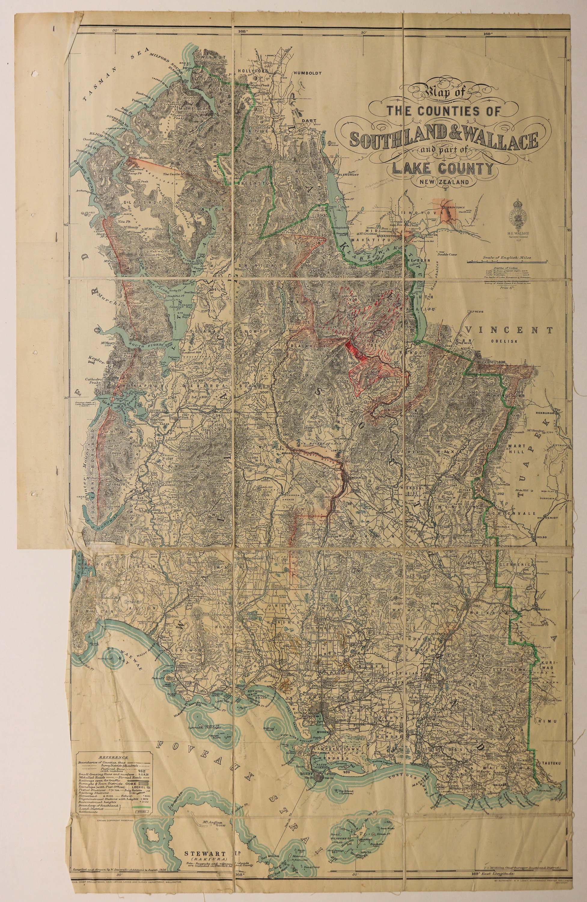
Map of the Counties of Southland and Wallace and part of Lake County New Zealand
Scope and Contents
Includes Survey Districts, Hundreds and Pastoral Runs. Hand-drawn additions in red ink and pencil.
Dates
- 1936
- Publication: 1937
Creator
- New Zealand. Department of Lands and Survey (Publisher, Organization)
Conditions Governing Use
This item has no known copyright restrictions. Please reference Invercargill City Libraries and Archives A0001_S00100002_ar when re-using this image.
Extent
From the Series: 33 maps/plans (Map-Boxes 1 - 8 and Drawer West 6 d)
Language of Materials
From the Item: English
Expand All
Existence and Location of Copies
To obtain a high resolution copy of this image please contact the Archive.
Physical Description
Fabric backed paper.
Dimensions
H 1130mm x W 650mm
Content Notes
Seal of NZ Lands & Survey. H E Walsh, Surveyor General, 1937.
Compiled and drawn by W Deverell, additions 1936. J Wicks, Chief Draughtsman, Wellington.
T S McMillan, Chief Surveyor, Southland District.
By Authority: G H Loney, Government Printer, Wellington.
Compiled and drawn by W Deverell, additions 1936. J Wicks, Chief Draughtsman, Wellington.
T S McMillan, Chief Surveyor, Southland District.
By Authority: G H Loney, Government Printer, Wellington.
Creator
- New Zealand. Department of Lands and Survey (Publisher, Organization)
- Deverell, W. (Cartographer, Person)
Repository Details
Part of the Invercargill City Council Archives Repository
Contact:
50 Dee Street
Private Bag 90111
Invercargill Southland 9810 New Zealand
archives@icc.govt.nz
50 Dee Street
Private Bag 90111
Invercargill Southland 9810 New Zealand
archives@icc.govt.nz
