Map of the North Island, New Zealand. Shewing the Land Tenure, June 30th 1878, 1878
Component — map-box: 3
Identifier: S00100024_c
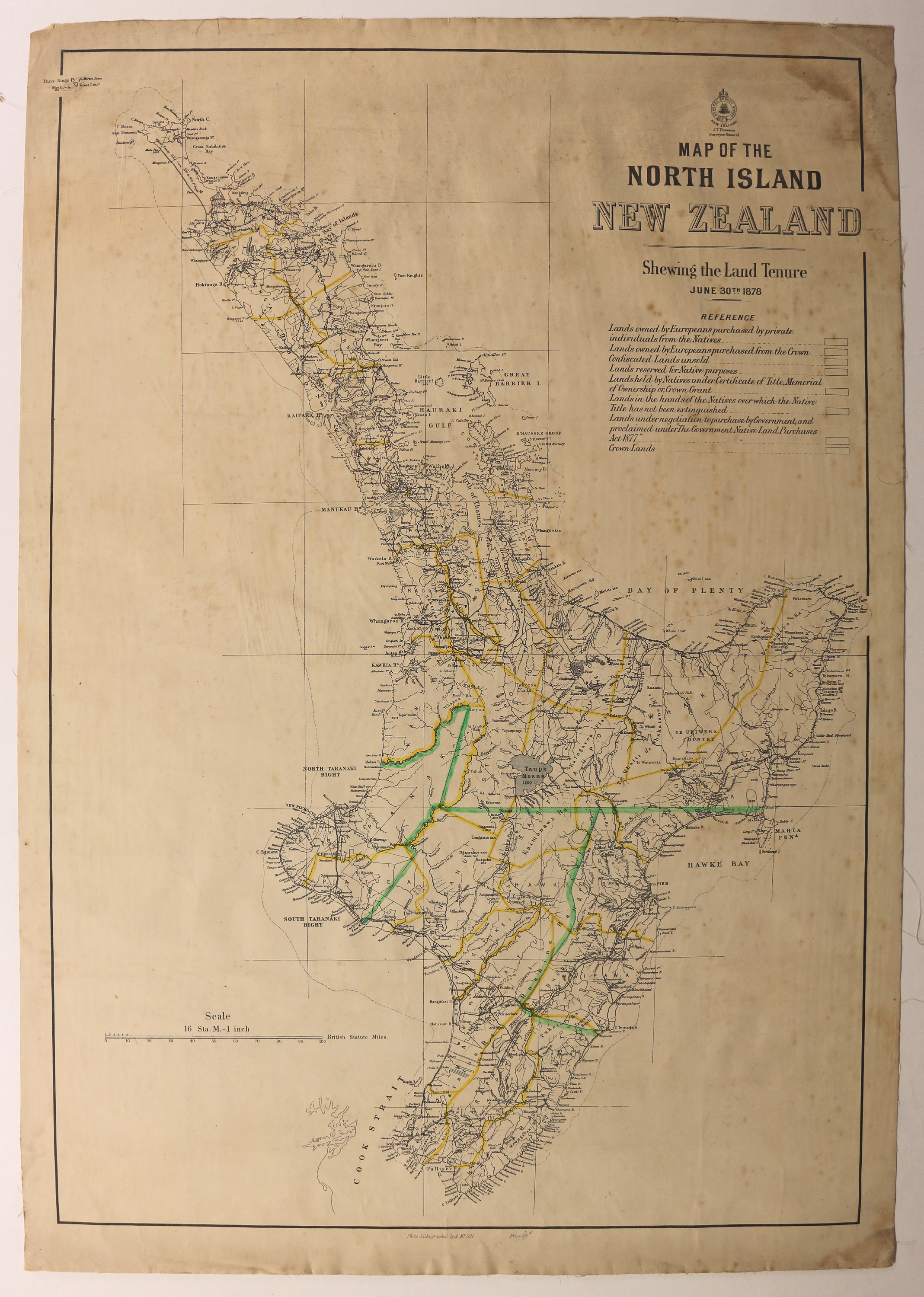
Map of the North Island, New Zealand. Shewing the Land Tenure, June 30th 1878
Scope and Contents
Map of the North Island drawn 30th June 1878 to show land tenure. The reference key is not filled in, nor are the corresponding areas on the map. Yellow and green lines to show boundaries are a later addition.
Dates
- 1878
Creator
- New Zealand. General Survey Office (Publisher, Organization)
Conditions Governing Use
This item has no known copyright restrictions. Please acknowledge Invercargill City Libraries and Archives, Ref: A0001 S00100024_c, when re-using this image.
Extent
From the Series: 33 maps/plans (Map-Boxes 1 - 8 and Drawer West 6 d)
Language of Materials
From the Item: English
Expand All
Existence and Location of Copies
To obtain a high resolution copy of this image please contact the Archive.
Physical Description
Fabric backed paper.
Dimensions
H 920mm x W 640mm
Content Notes
Photo-Lithographed by A. McColl.
General Survey Office. Surveyor General J.T. Thomson.
General Survey Office. Surveyor General J.T. Thomson.
Creator
- New Zealand. General Survey Office (Publisher, Organization)
- McColl, Alex (Lithographer, Person)
Repository Details
Part of the Invercargill City Council Archives Repository
Contact:
50 Dee Street
Private Bag 90111
Invercargill Southland 9810 New Zealand
archives@icc.govt.nz
50 Dee Street
Private Bag 90111
Invercargill Southland 9810 New Zealand
archives@icc.govt.nz
