Map of the North Island, New Zealand. To Accompany Survey Report, 1883, 1883
Component — map-box: 3
Identifier: S00100024_b
Map of the North Island, New Zealand. To Accompany Survey Report, 1883
Scope and Contents
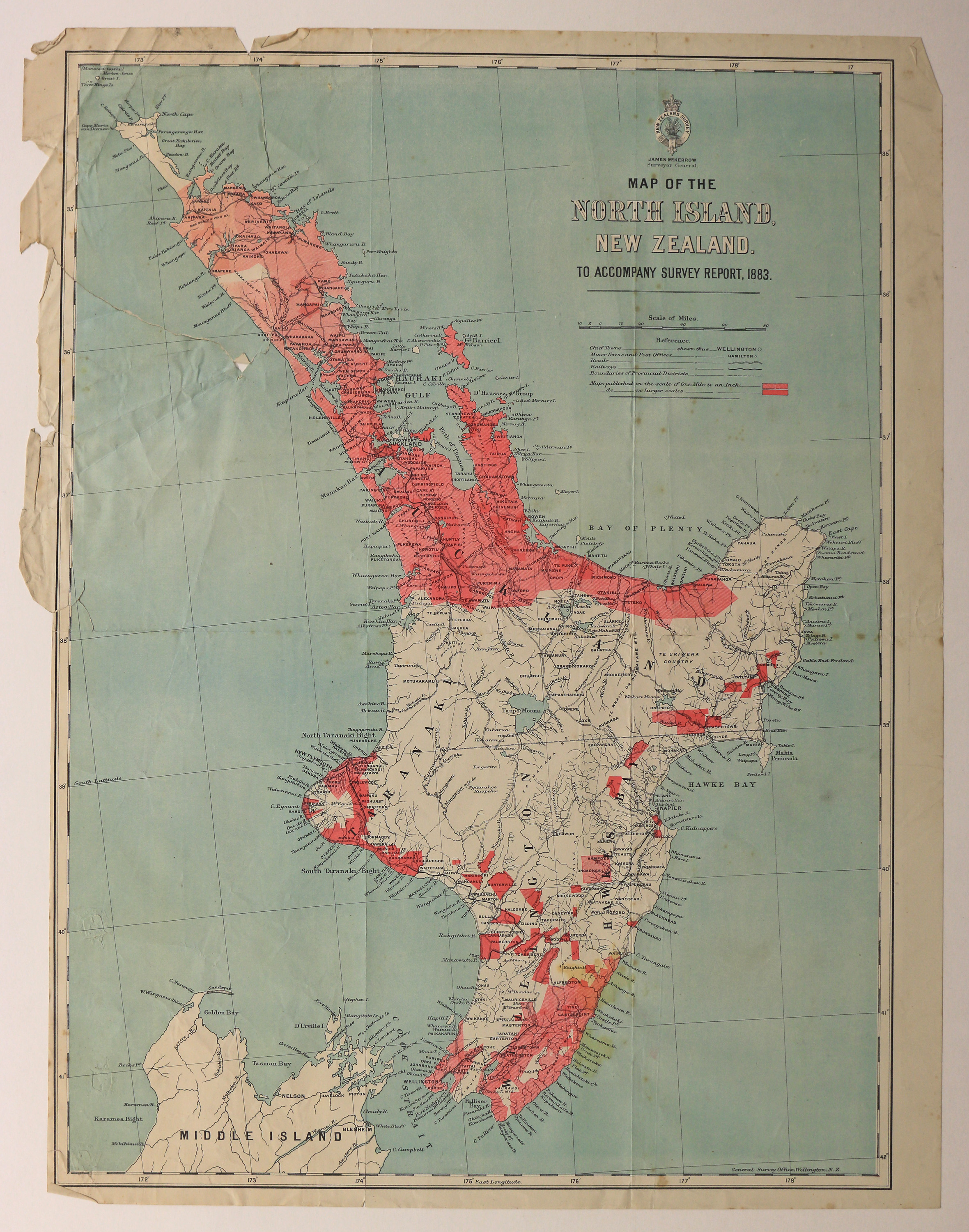
Map of the North Island of New Zealand. Drawn to accompany the 'Surveys of New Zealand Report 1882 - 1883' from the Surveyor General James McKerrow to the Honourable Minister of Lands. Shows areas where maps were published on the scale of one mile to an inch and those published on a larger scale.
Dates
- 1883
Creator
- New Zealand. General Survey Office (Publisher, Organization)
Conditions Governing Use
This item has no known copyright restrictions. Please acknowledge Invercargill City Libraries and Archives, Ref: A0001 S00100024_b, when re-using this image.
Extent
From the Series: 33 maps/plans (Map-Boxes 1 - 8 and Drawer West 6 d)
Language of Materials
From the Item: English
Existence and Location of Copies
To obtain a high resolution copy of this image please contact the Archive.
Physical Description
Paper. Fold and tear damage.
Dimensions
H 565mm x W 435mm
Content Notes
Shown: Chief Cities, Minor Towns and Post Offices, Roads, Railways, and Boundaries of Provincial Districts.
General Survey Office, Wellington, N.Z.
General Survey Office, Wellington, N.Z.
Creator
- New Zealand. General Survey Office (Publisher, Organization)
Repository Details
Part of the Invercargill City Council Archives Repository
Contact:
50 Dee Street
Private Bag 90111
Invercargill Southland 9810 New Zealand
archives@icc.govt.nz
50 Dee Street
Private Bag 90111
Invercargill Southland 9810 New Zealand
archives@icc.govt.nz
