Plan of Subdivision of Part of Upper Glenham Estate, Wyndham District, c.1880
Item — drawer: West 5 b
Identifier: S00800078
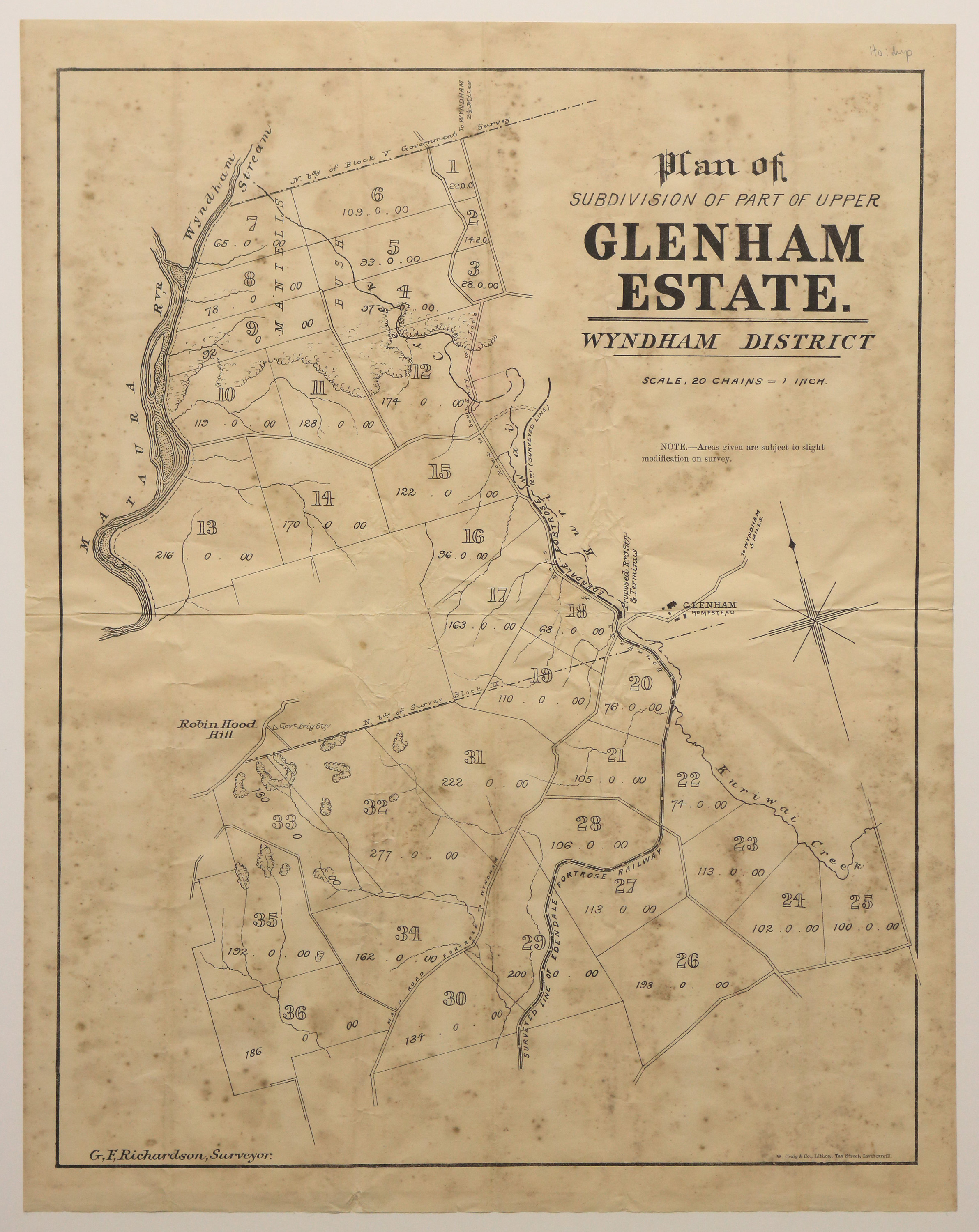
Plan of Subdivision of Part of Upper Glenham Estate, Wyndham District
Dates
- c.1880
Creator
- Richardson, G. F. (George Frederick) (Surveyor, Person)
Extent
From the Series: 82 maps/plans (Box 4, Drawers West 5 b, c and e, Map-boxes 5 - 10, Frame: Research Room Wall, Digital Archive.)
Language of Materials
English
Expand All
Physical Description
Paper.
Dimensions
552 mm x 433 mm
Map Notes
Surveyor, G. F. Richardson.
W. Craig & Co, Lithos, Tay street, Invercargill.
Scale of map: 20 chains = 1 inch.
Creator
- Richardson, G. F. (George Frederick) (Surveyor, Person)
Repository Details
Part of the Invercargill City Council Archives Repository
Contact:
50 Dee Street
Private Bag 90111
Invercargill Southland 9810 New Zealand
archives@icc.govt.nz
50 Dee Street
Private Bag 90111
Invercargill Southland 9810 New Zealand
archives@icc.govt.nz
