Wise's Larger Scale Map of Otago compiled from Official Surveys, 1875
Component — map-box: 7
Identifier: S00100002_ae
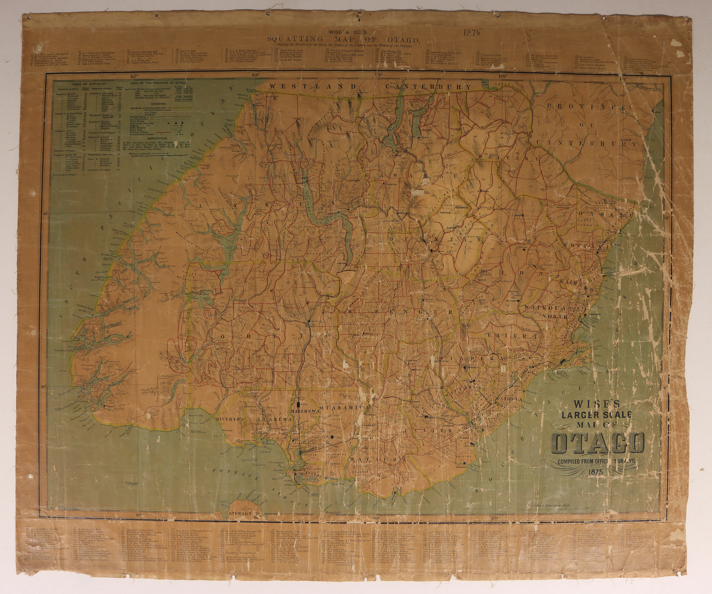
Wise & Co.'s Squatting Map of Otago
Scope and Contents
Wise & Co's Squatting Map of Otago, showing the Numbers of the Runs, the Names of the Lessees, and the Names of the Stations.
Dates
- 1875
Conditions Governing Use
This item has no known copyright restrictions. Please acknowledge Invercargill City Libraries and Archives, Ref: A0001 S00100002_ae, when re-using this image.
Extent
From the Series: 33 maps/plans (Map-Boxes 1 - 8 and Drawer West 6 d)
Language of Materials
English
Existence and Location of Copies
To obtain a high resolution copy of this image please contact the Archive.
Physical Description
Fabric backed paper. Small portions missing due to surface area damage.
Dimensions
H 835mm x W 605
Content Notes
Squatters are named and located by numbers.
Lithographed by D Henderson.
Lithographed by D Henderson.
Repository Details
Part of the Invercargill City Council Archives Repository
Contact:
50 Dee Street
Private Bag 90111
Invercargill Southland 9810 New Zealand
archives@icc.govt.nz
50 Dee Street
Private Bag 90111
Invercargill Southland 9810 New Zealand
archives@icc.govt.nz
