Alton Survey District
Digital Image
Identifier: D00100002_au
Alton Survey District
Dates
- Sept. 1901, additions to Feb. 1929
Creator
- New Zealand. Department of Lands and Survey (Publisher, Organization)
Summary
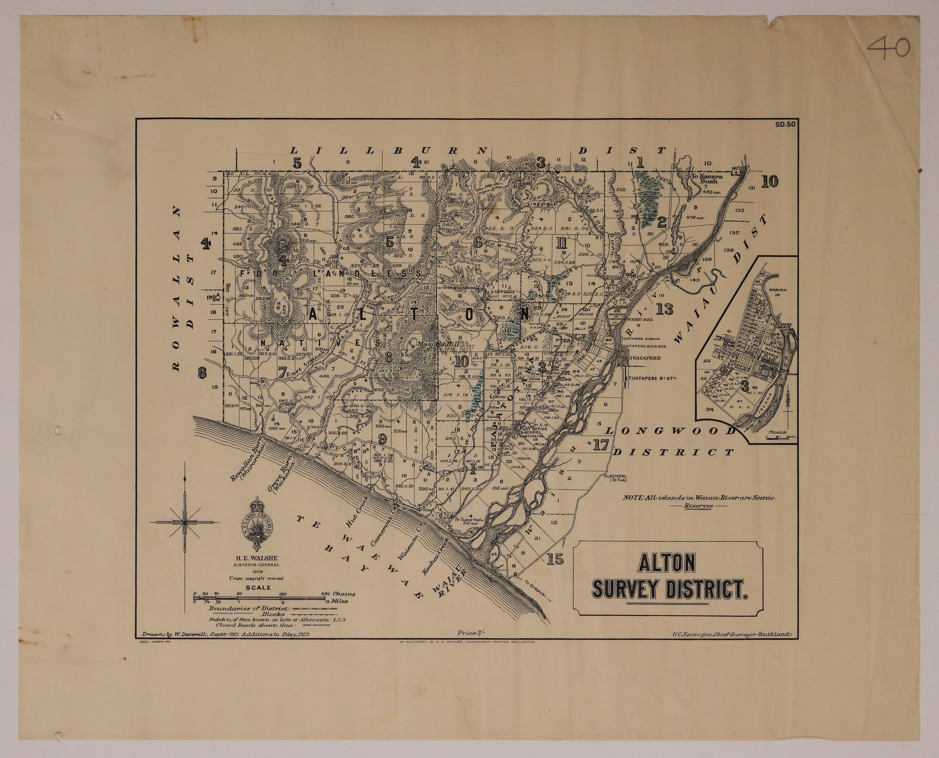
Cadastral map of Alton Survey District, Western Southland.
Conditions Governing Use
This item has no known copyright restrictions. Please reference Invercargill City Libraries and Archives A0001 S00100002_au when re-using this image.
Extent
1 digital object : TIFF file.
Existence and Location of Copies
To obtain a high resolution copy of this image please contact the Archive.
Physical Description
Paper.
Dimensions
H 415mm x W 480mm
Content Notes
Bounded by Te Wae Wae Bay; Longwood, Waiau, Lilburn and Rowallan Districts.
Inset map: Town of Tuatapere including Tuatapere Domain, Tuatapere Scenic Reserve and the Waiau River.
Noted features/areas: Te Tua School, Tuatapere Railway Station, Waiau River, Papatotara, Mason's Hill, Te Karara Bush and area "For Landless Natives".
Official Seal of NZ Survey. H. E. Walshe, Surveyor General, 1929. Drawn by W Deverell, Sept 1901. Additions to Febry, 1929. N C Kensington, Chief Surveyor, Southland. W A G Skinner, Government Printer.
Map number: S.D.50
Creator
- New Zealand. Department of Lands and Survey (Publisher, Organization)
- Deverell, W. (Draftsman, Person)
Repository Details
Part of the Invercargill City Council Archives Repository
Contact:
50 Dee Street
Private Bag 90111
Invercargill Southland 9810 New Zealand
archives@icc.govt.nz
50 Dee Street
Private Bag 90111
Invercargill Southland 9810 New Zealand
archives@icc.govt.nz
