Black Hill, Burwood and Lincoln Survey Districts
Digital Image
Identifier: D00100002_ax
Black Hill, Burwood and Lincoln Survey Districts
Dates
- 1913
- Publication: 1920
Creator
- New Zealand. Department of Lands and Survey (Publisher, Organization)
Summary
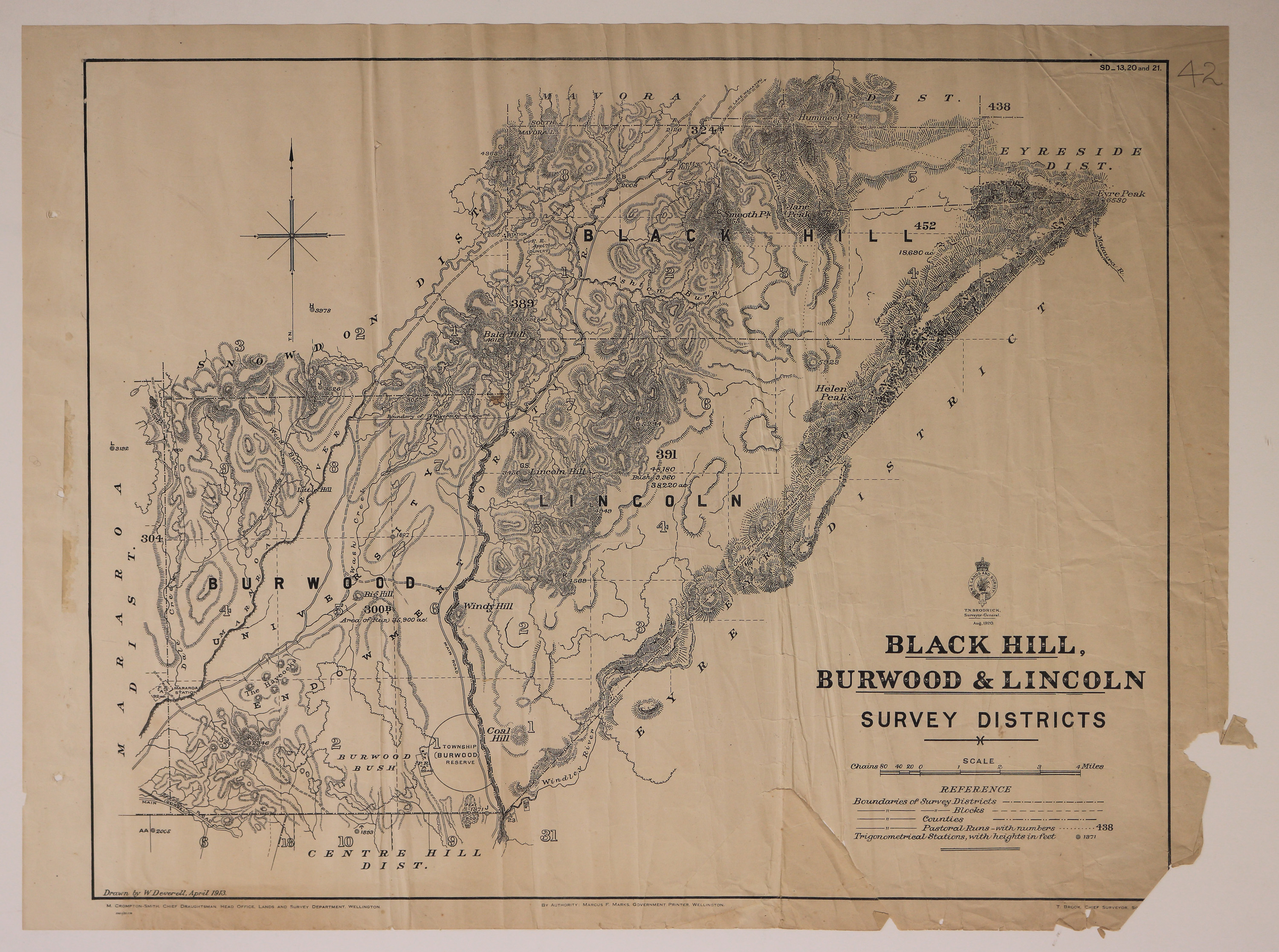
Map of Black Hill, Burwood and Lincoln Survey Districts, including Pastoral Runs.
Conditions Governing Use
This item has no known copyright restrictions. Please reference Invercargill City Libraries and Archives A0001 S00100002_ax when re-using this image.
Extent
1 digital object : TIFF file.
Expand All
Existence and Location of Copies
To obtain a high resolution copy of this image please contact the Archive.
Physical Description
Paper.
Dimensions
H 570mm x W 670mm
Content Notes
Official Seal of NZ Lands & Survey, T N Brodrick, Surveyor General. 1920.
Drawn by W Deverell, April 1913.
M Crompton-Smith, Chief Draughtsman, Wellington. Marcus F Marks, Government Printer. T Brook, Chief Surveyor, Southland.
Includes: Centre Hill, Eyre, Eyreside, Mavora, Snowdon and Mararoa Districts.
SD_13, 20 and 21.
Number 42 in pencil upper right-hand corner.
Drawn by W Deverell, April 1913.
M Crompton-Smith, Chief Draughtsman, Wellington. Marcus F Marks, Government Printer. T Brook, Chief Surveyor, Southland.
Includes: Centre Hill, Eyre, Eyreside, Mavora, Snowdon and Mararoa Districts.
SD_13, 20 and 21.
Number 42 in pencil upper right-hand corner.
Creator
- New Zealand. Department of Lands and Survey (Publisher, Organization)
- Deverell, W. (Draftsman, Person)
Repository Details
Part of the Invercargill City Libraries and Archives Repository
