Coneburn Survey District
Digital Image
Identifier: D00100002_be
Coneburn Survey District
Dates
- 1918
Creator
- New Zealand. Department of Lands and Survey (Publisher, Organization)
Conditions Governing Use
This item has no known copyright restrictions. Please reference Invercargill City Libraries and Archives A0001 S00100002_be when re-using this image.
Extent
1 digital object : TIFF file.
Expand All
Existence and Location of Copies
To obtain a high resolution copy of this image please contact the Archive.
Physical Description
Paper.
Dimensions
H 430mm x W 310mm
Content Notes
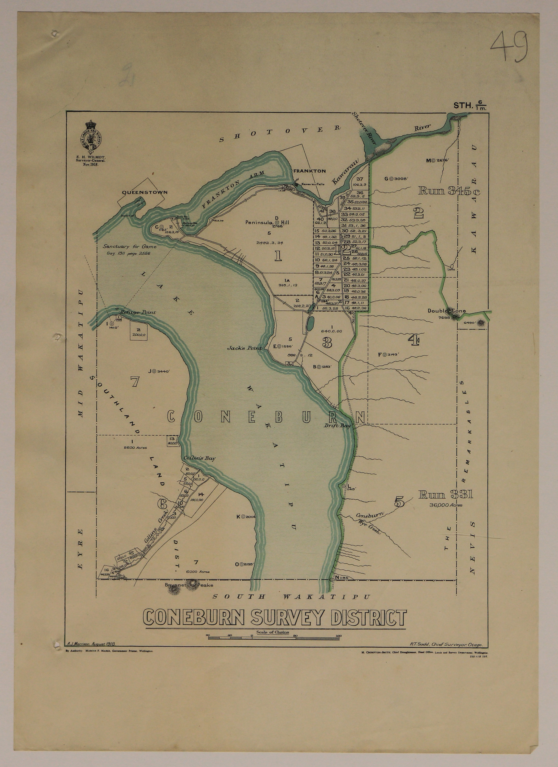
Official Seal of NZ Lands & Survey. E H Wilmot, Surveyor General. 1918.
A J Morrison. R T Sadd, Chief Surveyor, Otago. M Crompton-Smith, Chief Draughtsman. Marcus F Marks, Government Printer.
Bounded by South Wakatipu, Nevis, Kawarau, Shotover, Mid Wakatipu, Eyre.
Features: Lake Wakatipu, Frankton Arm, Frankton, Bayonet Peaks, Queenstown, Double Cone, Jack's Point, The Remarkables, Collin's Bay, Drift Bay, Refuge Point.
STH. 6/1m.
Creator
- New Zealand. Department of Lands and Survey (Publisher, Organization)
- Morrison , A. J. (Andrew Jollie) (Cartographer, Person)
Repository Details
Part of the Invercargill City Council Archives Repository
Contact:
50 Dee Street
Private Bag 90111
Invercargill Southland 9810 New Zealand
archives@icc.govt.nz
50 Dee Street
Private Bag 90111
Invercargill Southland 9810 New Zealand
archives@icc.govt.nz
