Eyre, Nokomai, Kingston, Eyreside and Garvie Survey Districts
Digital Image
Identifier: D00100002_bf
Eyre, Nokomai, Kingston, Eyreside and Garvie Survey Districts
Dates
- June 1894, additions to Sept. 1915
- Publication: 1922
Creator
- New Zealand. Department of Lands and Survey (Publisher, Organization)
Conditions Governing Use
This item has no known copyright restrictions. Please reference Invercargill City Libraries and Archives A0001 S00100002_bf when re-using this image.
Extent
1 digital object : TIFF file.
Expand All
Existence and Location of Copies
To obtain a high resolution copy of this image please contact the Archive.
Physical Description
Paper.
Dimensions
H 750mm x W 960mm
Content Notes
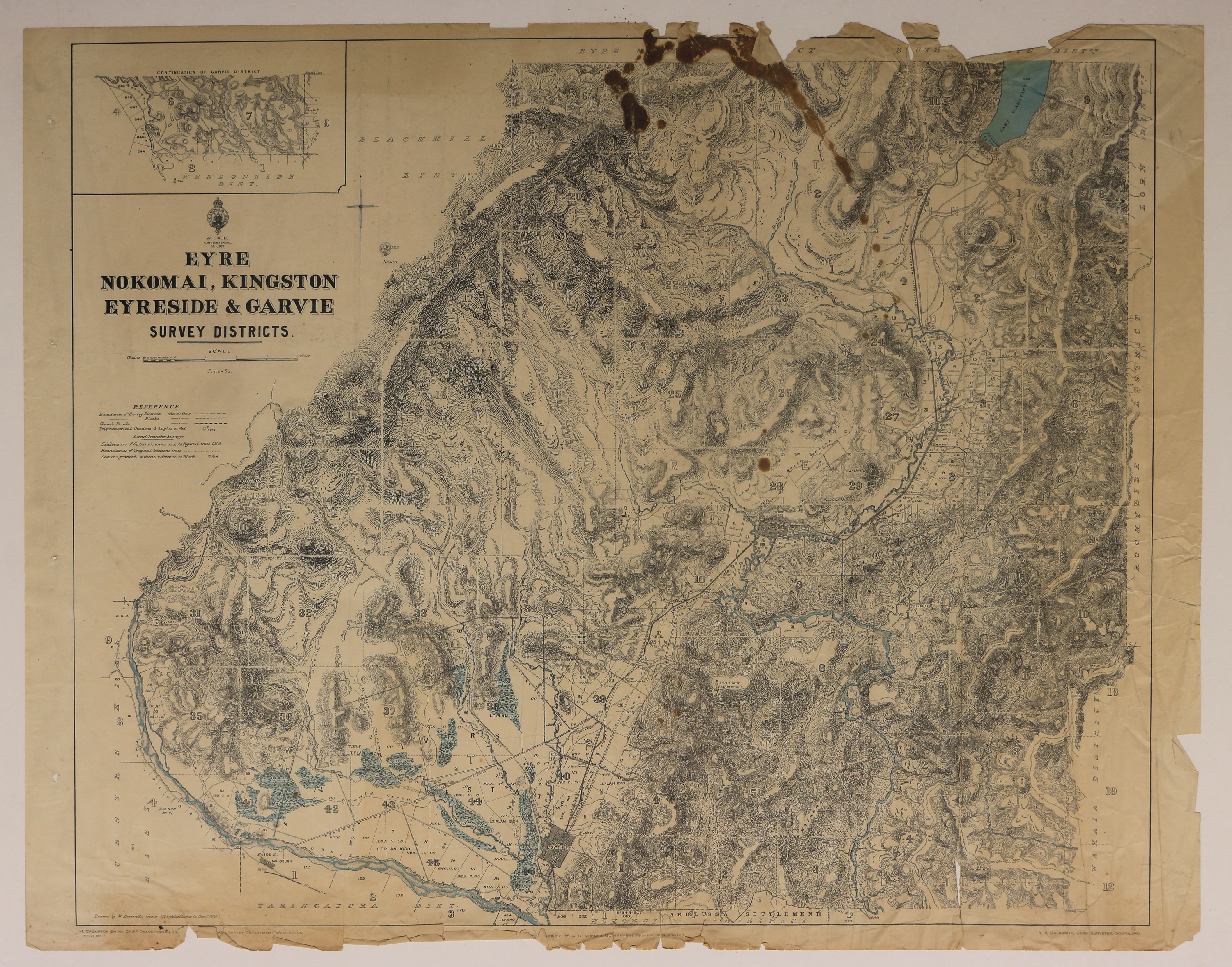
Official Seal of NZ Lands & Survey. W T Neill, Surveyor General. 1922.
Drawn by W Deverell June 1894, additions to Sep 1915. M Crompton-Smith, Chief Draughtsman. R S Galbraith, Chief Surveyor, Southland. W A G Skinner, Government Printer.
Bordered by: Blackhill, Eyre North, South Wakatipu, Lorn, Rockyside, Wakaia, Hokonui, Taringatura, and Centre Hill Districts.
Features: Towns of Lowther, Athol, and Kingston. Lake Wakatipu, Mossburn, Oreti River, and Mataura River.
Inset: Continuation of Garvie District.
Creator
- New Zealand. Department of Lands and Survey (Publisher, Organization)
- Deverell, W. (Draftsman, Person)
Repository Details
Part of the Invercargill City Libraries and Archives Repository
