Map of Aparima, Oreti and part of Jacobs River Hundred
Digital Image
Identifier: D00100002_av
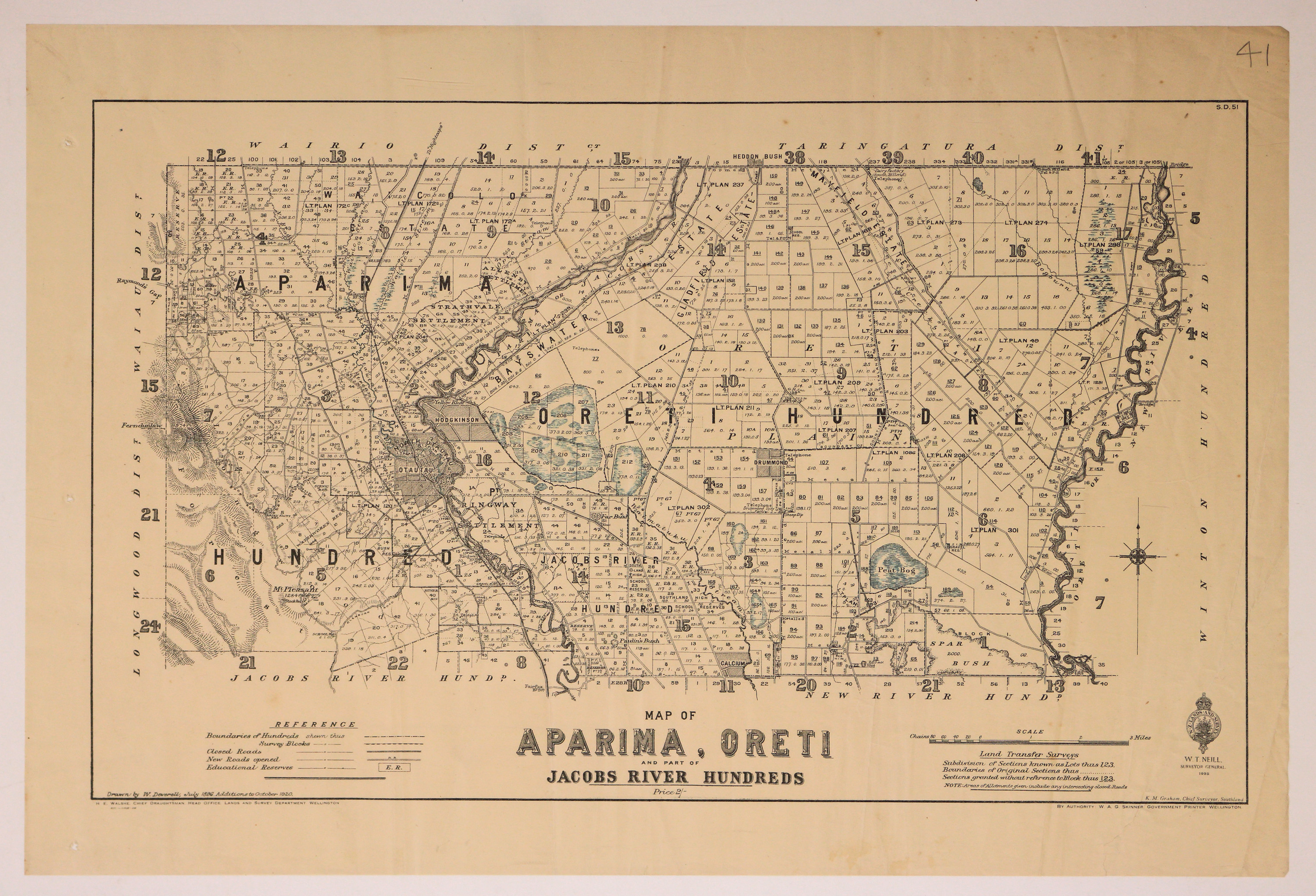
Map of Aparima, Oreti and part of Jacobs River Hundred
Dates
- July 1896, additions to October 1920
- Publication: 1925
Creator
- Deverell, W. (Draftsman, Person)
Summary
Map of the Aparima, Oreti Hundreds, with part of Jacob's River Hundred.
Conditions Governing Use
This item has no known copyright restrictions. Please reference Invercargill City Libraries and Archives A0001 S00100002_av when re-using this image.
Extent
1 digital object : TIFF file.
Existence and Location of Copies
To obtain a high resolution copy of this image please contact the Archive.
Physical Description
Paper.
Dimensions
H 432mm x W 600mm
Content Notes
Official Seal of NZ Lands & Survey. W T Neill, Surveyor General, 1925
Drawn by W Deverell, Jul 1869. additions to October 1920.
H E Walshe, Chief Draughtsman, Wellington. K M Graham, Chief Surveyor, Invercargill.
W A G Skinner, Government Printer.
S.D.51
Bordered by: Wairio, Taringatura, Longwood and Waiau Districts.
Bogs marked in blue pencil.
Drawn by W Deverell, Jul 1869. additions to October 1920.
H E Walshe, Chief Draughtsman, Wellington. K M Graham, Chief Surveyor, Invercargill.
W A G Skinner, Government Printer.
S.D.51
Bordered by: Wairio, Taringatura, Longwood and Waiau Districts.
Bogs marked in blue pencil.
Creator
- Deverell, W. (Draftsman, Person)
- New Zealand. Department of Lands and Survey (Publisher, Organization)
Repository Details
Part of the Invercargill City Libraries and Archives Repository
