Map of Campbelltown Hundred Southland N.Z.
Digital Image
Identifier: D00100002_ay
Map of Campbelltown Hundred Southland N.Z.
Dates
- Sept. 1914. Additions to March 1935.
- Publication: 1935
Creator
- Potter, J.C. (James Cleghorn) (Draftsman, Person)
Summary
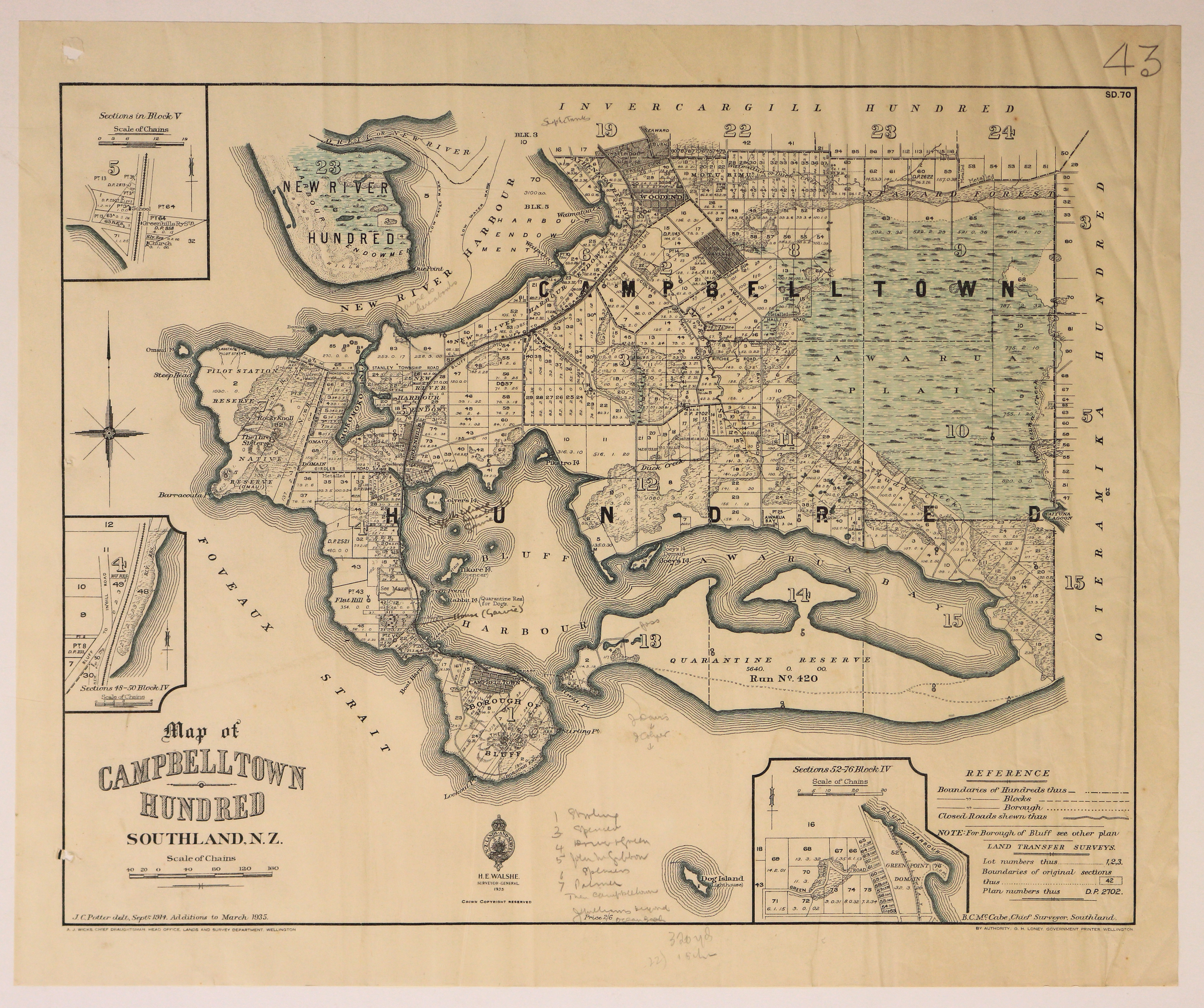
Map of the Campbelltown Hundred showing boundaries of Hundreds, Blocks and Boroughs.
Conditions Governing Use
This item has no known copyright restrictions. Please reference Invercargill City Libraries and Archives A0001 S00100002_ay when re-using this image.
Extent
1 digital object : TIFF file.
Existence and Location of Copies
To obtain a high resolution copy of this image please contact the Archive.
Physical Description
Paper.
Dimensions
H 433mm x W 480mm
Content Notes
Offical Seal of NZ Lands & Survey. H E Walshe, Surveyor General. 1935
A J Wicks, Chief Draughtsman, Lands and Survey Department Wellington.
Drawn by J C Potter, Sep 1914. Additions to 1935.
B C McCabe, Chief Surveyor, Southland.
Bordered by Foveaux Strait, Oteramika, Invercargill and New River Hundreds.
Features: Awarua Plain, New River Harbour, Bluff Harbour, Woodend, Motu Rimu, Campbelltown [Bluff], Quarantine Reserve, Awarua Bay, Waverley, Greenhills.
3 inset maps - Block V; Sections 52-76 , Block IV; Sections 48-50, Block IV.
Various hand written notes. No. 43 top right corner. SD.70.
Creator
- Potter, J.C. (James Cleghorn) (Draftsman, Person)
- New Zealand. Department of Lands and Survey (Publisher, Organization)
Repository Details
Part of the Invercargill City Council Archives Repository
Contact:
50 Dee Street
Private Bag 90111
Invercargill Southland 9810 New Zealand
archives@icc.govt.nz
50 Dee Street
Private Bag 90111
Invercargill Southland 9810 New Zealand
archives@icc.govt.nz
