Map of Part of North, Central and South Otago New Zealand
Digital Image
Identifier: D00100002_at
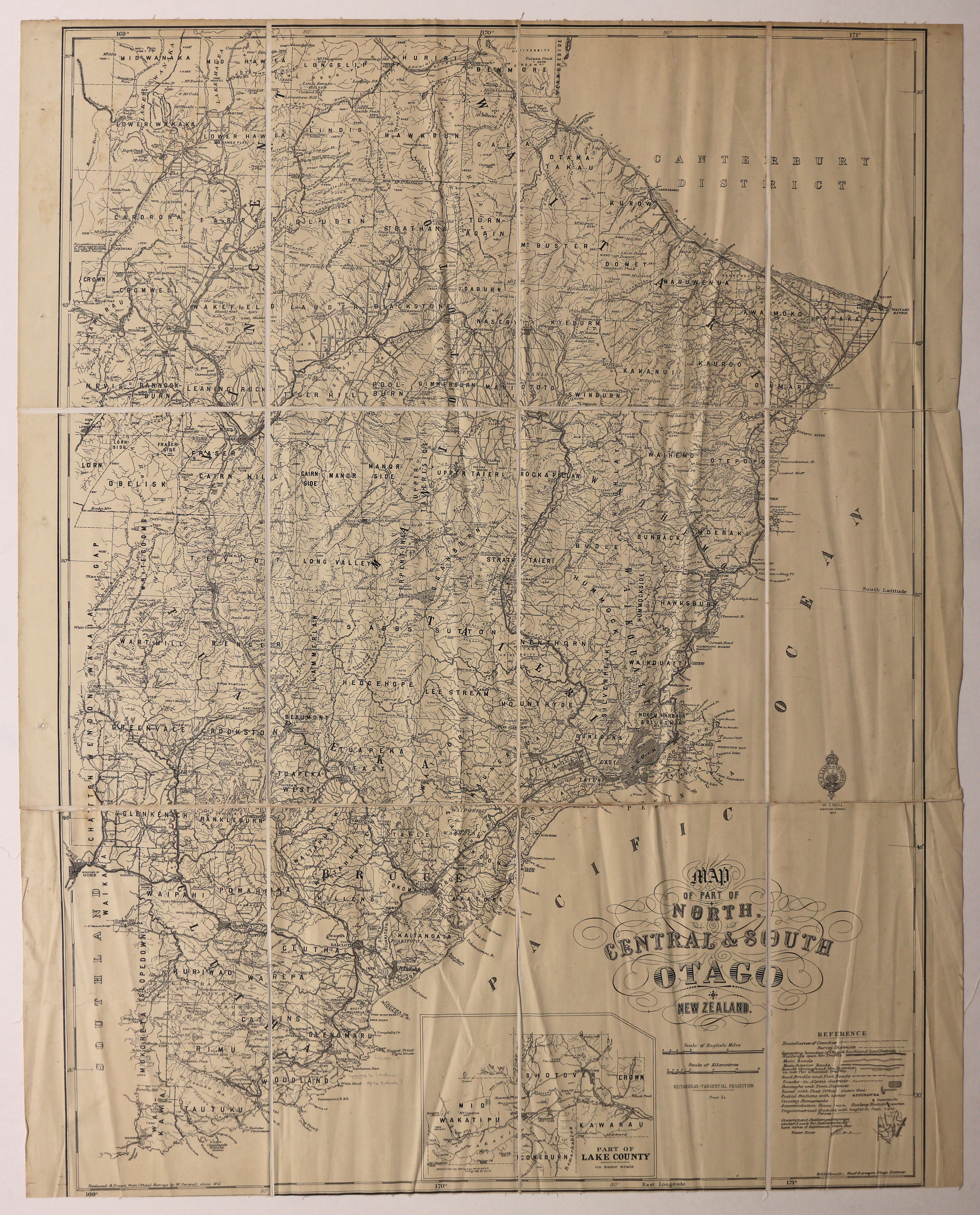
Map of part of North, Central and South Otago New Zealand
Dates
- 1915
- Publication: 1924
Creator
- New Zealand. Department of Lands and Survey (Publisher, Organization)
Summary
Map of Counties and Survey Districts, Otago. Reduced and Drawn from Official Surveys.
Conditions Governing Use
This item has no known copyright restrictions. Please reference Invercargill City Libraries and Archives A0001 S00100002_at when re-using this image.
Extent
1 digital object : TIFF file.
Expand All
Existence and Location of Copies
To obtain a high resolution copy of this image please contact the Archive.
Physical Description
Fabric backed paper.
Dimensions
H 1030mm x W 800mm
Content Notes
Official Seal of NZ Lands & Survey. W T Neill, Surveyor General, 1924.
Reduced and Drawn from Official Surveys by W. Deverall, June 1915.
R S Galbraith, Chief Surveyor, Otago.
Inset showing part of Lake County.
Reduced and Drawn from Official Surveys by W. Deverall, June 1915.
R S Galbraith, Chief Surveyor, Otago.
Inset showing part of Lake County.
Creator
- New Zealand. Department of Lands and Survey (Publisher, Organization)
- Deverell, W. (Draftsman, Person)
Repository Details
Part of the Invercargill City Libraries and Archives Repository
