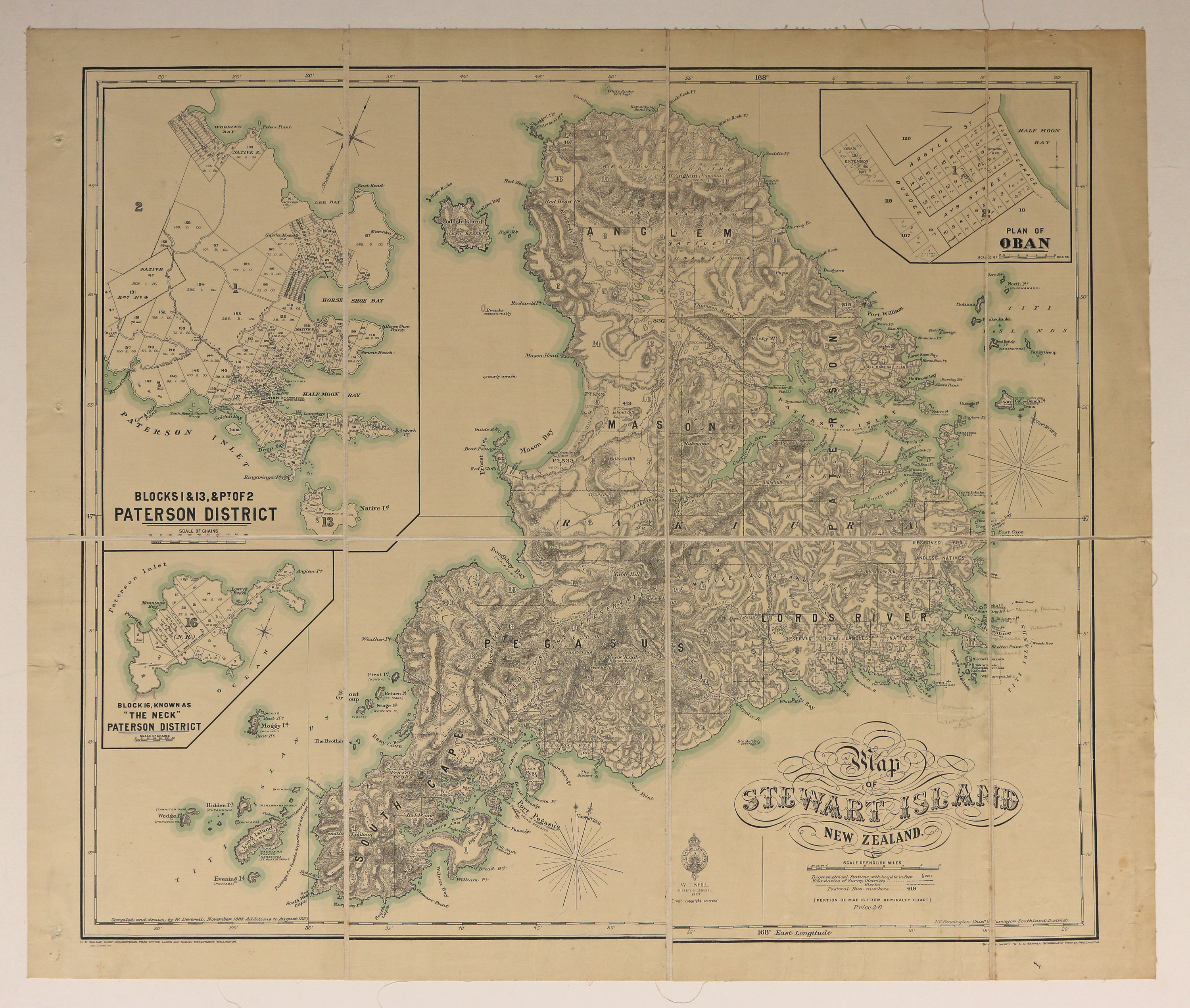
Map of Stewart Island New Zealand
Digital Image
Identifier: D00100002_as
Map of Stewart Island New Zealand
Dates
- November 1898, additions to August 1927
- Publication: 1927
Creator
- New Zealand. Department of Lands and Survey (Publisher, Organization)
Summary
Map of Stewart Island/Rakiura.
Conditions Governing Use
This item has no known copyright restrictions. Please reference Invercargill City Libraries and Archives A0001 S00100002_ar when re-using this image.
Extent
1 digital object : TIFF file.
Expand All
Existence and Location of Copies
To obtain a high resolution copy of this image please contact the Archive.
Physical Description
Fabric backed paper.
Dimensions
H 625mm x W 730mm
Content Notes
Insets: Plan of Oban; Paterson District, Blocks 1 & 13, Pt of 2; "The Neck" Paterson District Block 16.
Official Seal of NZ Lands and Survey. W T Neill, Surveyor General, 1927.
Compiled and drawn by W Deverell, November 1898. Additions to August 1927.
H E Walshe, Chief Draughtsman, Wellington. N C Kensington, Chief Surveyor, Southland.
W A G Skinner, Government Printer.
"Portion of map is from Admiralty Chart"
Includes Pastoral Runs.
Creator
- New Zealand. Department of Lands and Survey (Publisher, Organization)
- Deverell, W. (Cartographer, Person)
Repository Details
Part of the Invercargill City Council Archives Repository
Contact:
50 Dee Street
Private Bag 90111
Invercargill Southland 9810 New Zealand
archives@icc.govt.nz
50 Dee Street
Private Bag 90111
Invercargill Southland 9810 New Zealand
archives@icc.govt.nz
