Map of the Province of Otago
Digital Image
Identifier: D00100001_a
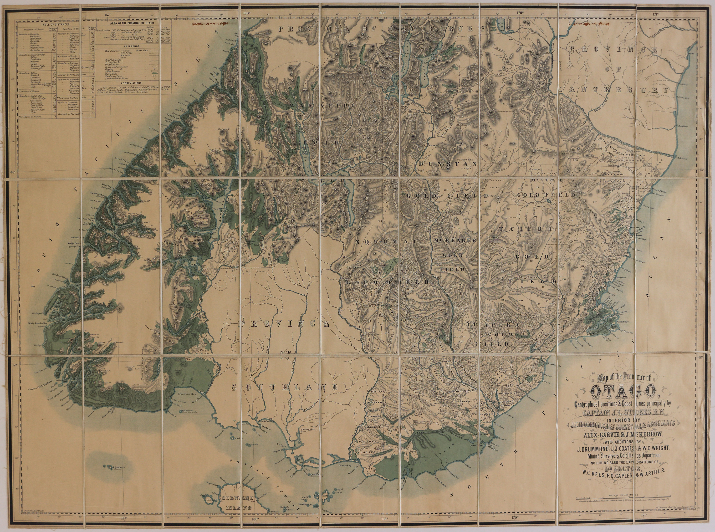
Map of the Province of Otago
Dates
- 1866
Creator
- Stokes, John Lort (Surveyor, Person)
Full Title
Map of the Province of Otago, Geographical positions & Coast Lines principally by Captain J. L. Stokes, R.N, Interior by J. T. Thomson, Chief Surveyor and Assistants Alex Garvie & J. McKerrow, with additions by J. Drummond, J. J. Coates & W. C. Wright, Mining Surveyors, Gold Fields Department, including also the explorations of Dr Hector, W. C. Rees, P. Q. Caples & W. Arthur.
Summary
Includes table of distances and area of the Province of Otago. Map includes Gold Field boundaries, Hundreds and Run Boundaries, metalled roads, dray tracks and bridle tracks, native reserves, heavy bush, Number of Runs and accommodation houses.
Conditions Governing Use
This item has no known copyright restrictions. Please reference Invercargill City Libraries and Archives A0001 S00100001_a when re-using this image.
Extent
1 digital object : TIFF file.
Existence and Location of Copies
To obtain a high resolution copy of this image please contact the Archive.
Physical Description
Heavy paper segments glued to linen.
Dimensions
H 612 mm x W 830mm
Content Notes
Compiled by Adam Rolland. Reduced and Drawn on Stone by W.W.J. Spreat at the Survey Office, Dunedin, Otago, N.Z. Printed by Alex McColl. J.T. Thomson, Chief Surveyor, January 1866.
Creator
- Stokes, John Lort (Surveyor, Person)
- Thomson, John Turnbull (Surveyor, Person)
Repository Details
Part of the Invercargill City Libraries and Archives Repository
