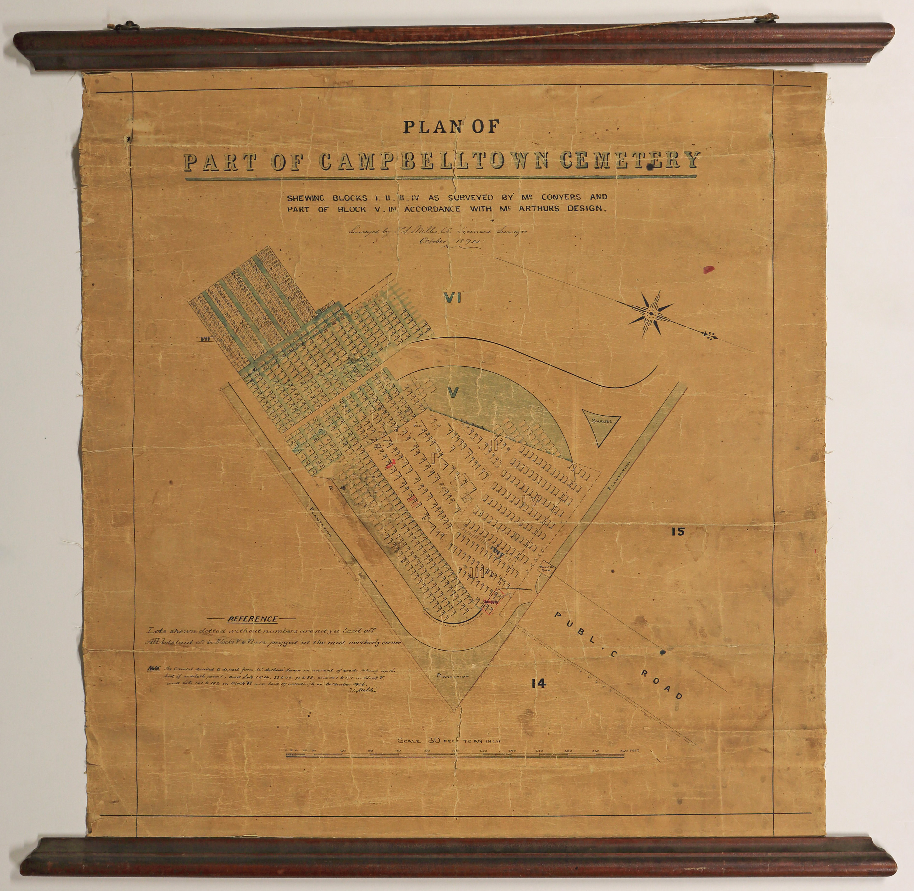
Plan of Part of Campbelltown Cemetery
Digital Image
Identifier: D00800058
Untitled
Dates
- 1894 [updated 1906]
Conditions Governing Use
This item has no known copyright restrictions. Please acknowledge Invercargill City Libraries and
Archives, Ref: A0010 S00800058, when re-using this image.
Language of Materials
English
Expand All
Existence and Location of Copies
To obtain a high resolution copy of this image please contact the Archive.
Dimensions
700mm x 668mm
Content Note
Sub title of map is - blocks I, II, III, IV, as surveyed by Mr Conyers and part of block V, in accordance with McArthurs design. Hand written - surveyed by T.S. Miller Licensed Surveyor October 1894. Map specifically shows area of V, VI and VI
Handwritten map note signed by T.S. Miller in lower left hand corner of map.
Detailing has separately numbered allotments, plantations, fences and public roads. Scale 30ft to 1 inch and reference to laid off lots.
Repository Details
Part of the Invercargill City Council Archives Repository
Contact:
50 Dee Street
Private Bag 90111
Invercargill Southland 9810 New Zealand
archives@icc.govt.nz
50 Dee Street
Private Bag 90111
Invercargill Southland 9810 New Zealand
archives@icc.govt.nz
