Plan of Popotunoa Estate
Digital Image
Identifier: D00800071
Untitled
Dates
- 1894
Conditions Governing Use
This item has no known copyright restrictions. Please acknowledge Invercargill City Libraries and
Archives, Ref: A0010 S00800071, when re-using this image.
Language of Materials
English
Expand All
Existence and Location of Copies
To obtain a high resolution copy of this image please contact the Archive.
Physical Description
Paper.
Dimensions
414 mm X 683 mm
Content Note
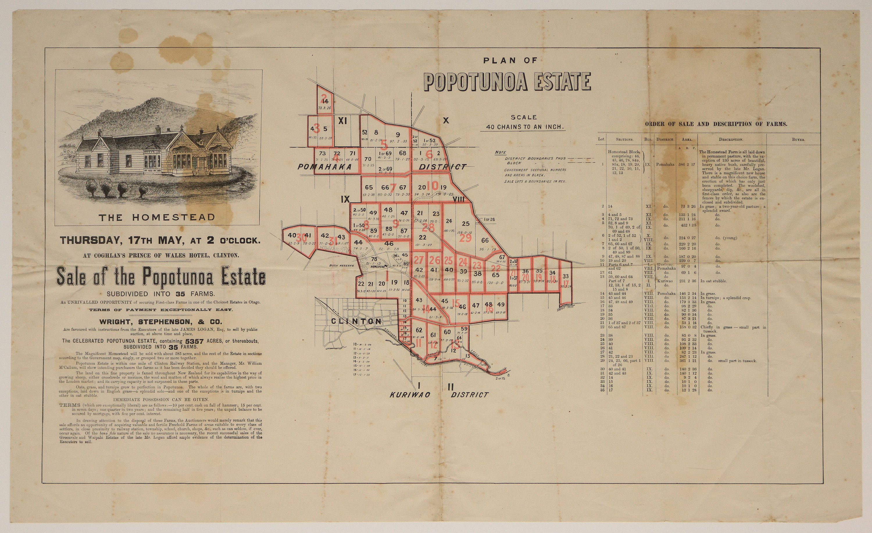
Plan shows the area of Pomahaka and Kuriwao District, and specifically the Popotunoa Estate mapping out the subdivision of 35 farms in red outline, that are for sale. Scale 40 chains to an inch. There is an enlarged map insert of Clinton township showing subdivision of sections as well as the position of the railway line through the township. The Map is advertising the upcoming Auction of subdivided farms by Wright, Stephenson and Co, including the main homestead on 585 acres as well as the order of the sale and description of each farm. The auction to be held 17 May at 2pm unknown year. There is no signature indication who draw this map.
Repository Details
Part of the Invercargill City Council Archives Repository
Contact:
50 Dee Street
Private Bag 90111
Invercargill Southland 9810 New Zealand
archives@icc.govt.nz
50 Dee Street
Private Bag 90111
Invercargill Southland 9810 New Zealand
archives@icc.govt.nz
