Waimea Estate, 1905
Item — map-box: 6
Identifier: S00800062
Waimea Estate
Dates
- 1905
Creator
- W. Craig & Co. (Lithographer, Organization)
Conditions Governing Use
This item has no known copyright restrictions. Please reference Invercargill City Libraries and Archives A0010 S00800062 when re-using this image.
Extent
From the Series: 82 maps/plans (Box 4, Drawers West 5 b, c and e, Map-boxes 5 - 10, Frame: Research Room Wall, Digital Archive.)
Language of Materials
English
Expand All
Existence and Location of Copies
To obtain a high resolution copy of this image please contact the Archive.
Physical Description
Paper.
Dimensions
H 456mm x W 588mm
Content Notes
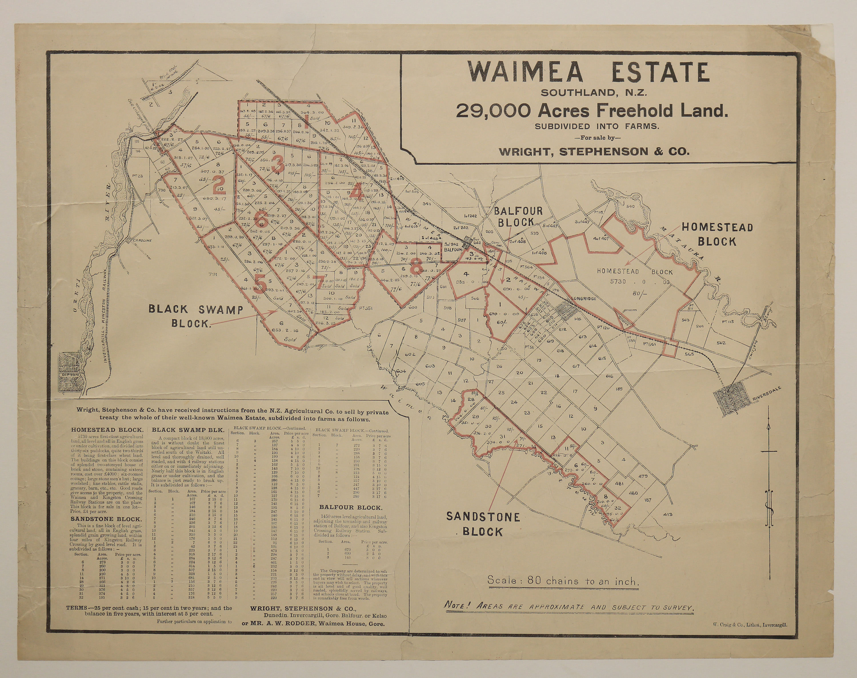
Subheading - "29,000 acres freehold land. Subdivided into farms. For sale by Wright, Stephenson and Co".
Map shows Black Swamp, Balfour, Homestead and Sandstone blocks. Scale 80 chaings to an inch. Note on lower edge of map "Note! Areas are approximate and subject to survey".
Lower left hand corner of map gives detailed information of each of the four blocks including overall acres which is then broken down into section numbers, acres and price per acre, as well as terms of purchase.
Creator
- W. Craig & Co. (Lithographer, Organization)
Repository Details
Part of the Invercargill City Libraries and Archives Repository
