Wise & Co.'s Squatting Map of Otago
Digital Image
Identifier: D00100002_ae
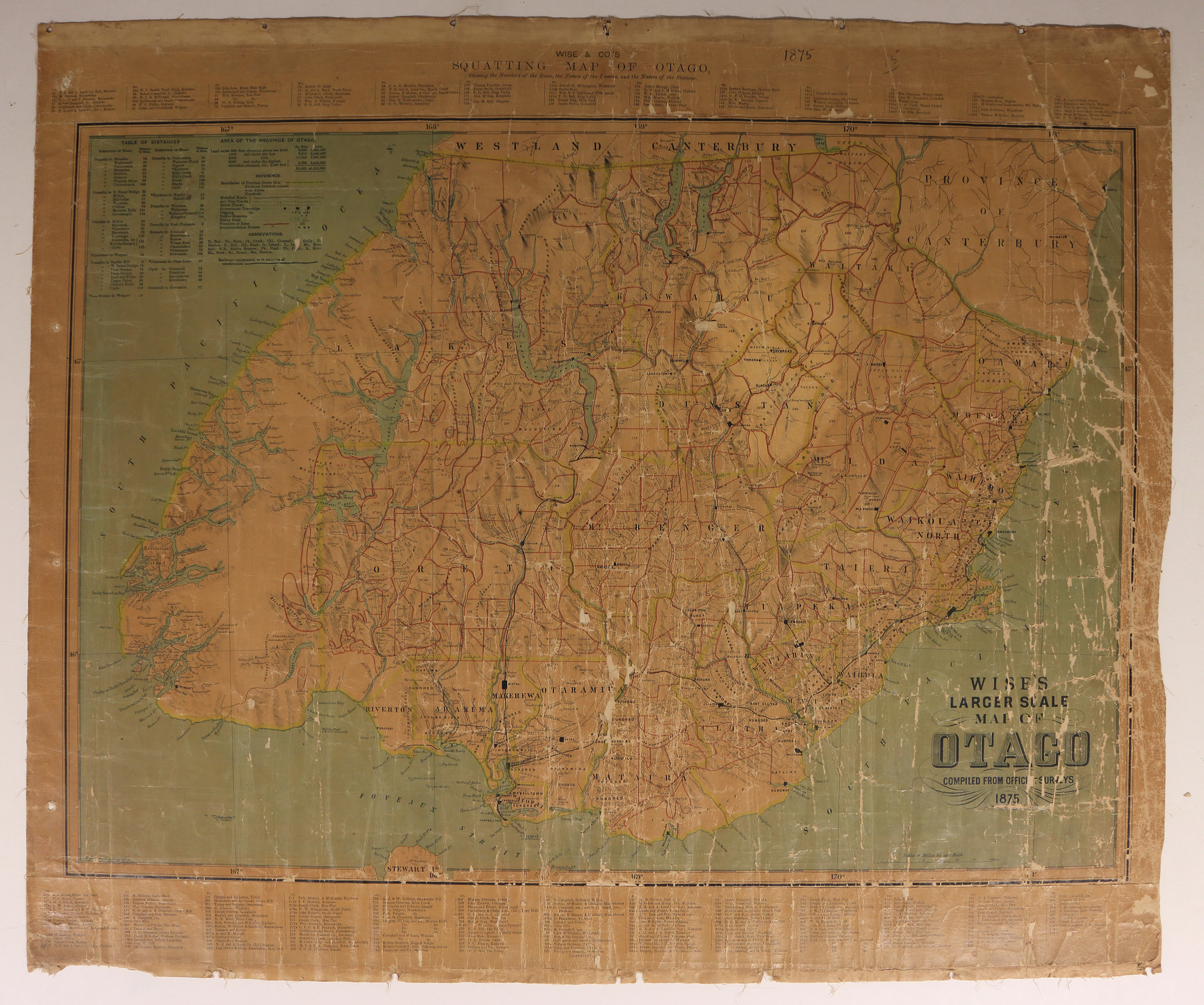
Wise & Co.'s Squatting Map of Otago
Dates
- 1875
Summary
Wise & Co's Squatting Map of Otago, showing the Numbers of the Runs, the Names of the Lessees, and the Names of the Stations.
Conditions Governing Use
This item has no known copyright restrictions. Please acknowledge Invercargill City Libraries and Archives, Ref: A0001 S00100002_ae, when re-using this image.
Extent
1 digital object : TIFF file.
Language of Materials
English
Existence and Location of Copies
To obtain a high resolution copy of this image please contact the Archive.
Physical Description
Fabric backed paper. Small portions missing due to surface area damage.
Dimensions
H 835mm x W 605mm
Content Note
Squatters are named and located by numbers.
Lithographed by D Henderson.
Lithographed by D Henderson.
Repository Details
Part of the Invercargill City Libraries and Archives Repository
