Area Defined by Invercargill Public Offices, c.1875
Item — map-box: 6
Identifier: S00800055
Area Defined by Invercargill Public Offices
Scope and Contents
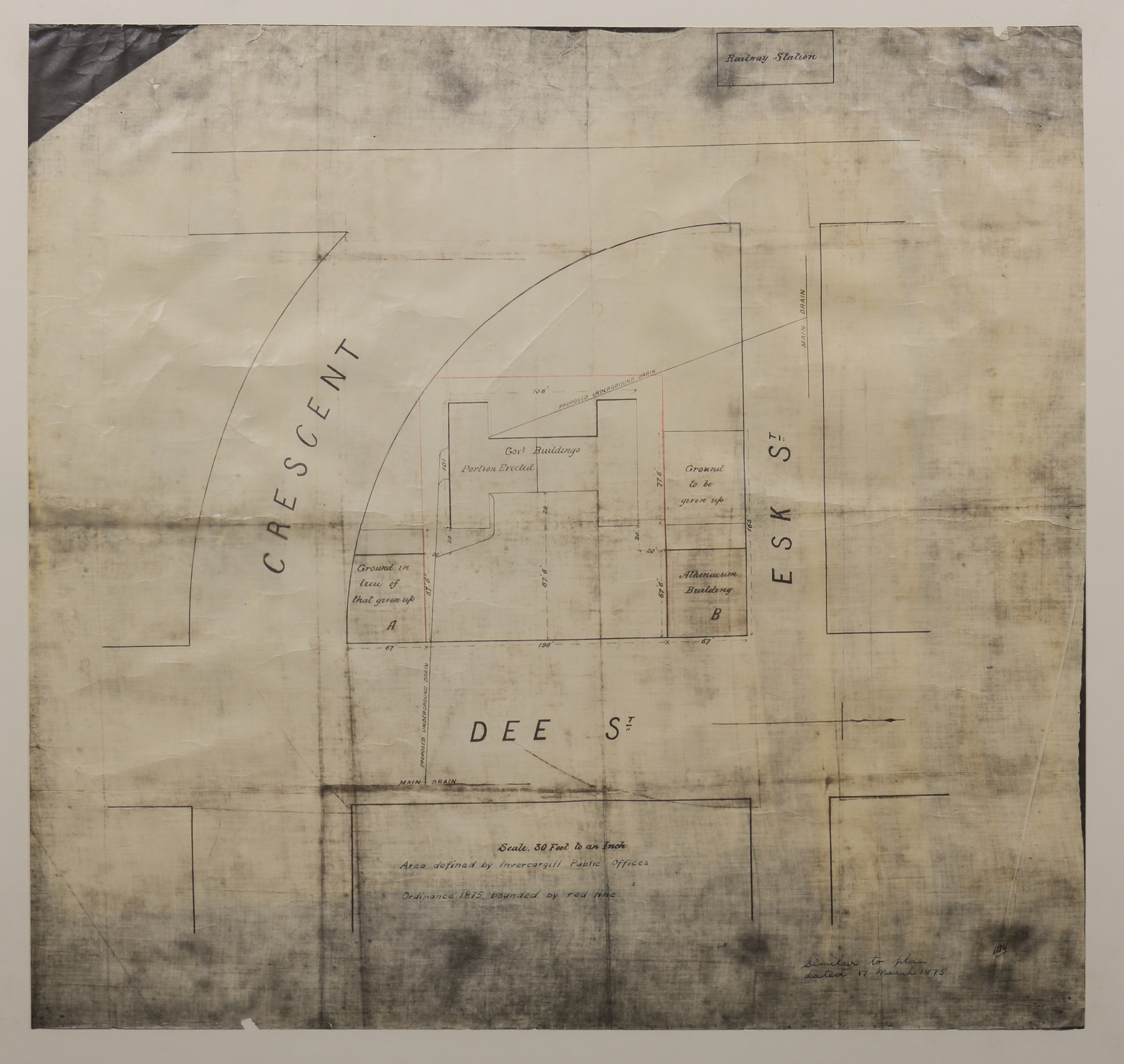
Block plan of the area bordered by Dee Street, Esk Street and the Crescent. Features Government Buildings, Athenaeum, and Railway Station.
Dates
- c.1875
Conditions Governing Use
This item has no known copyright restrictions. Please acknowledge Invercargill City Libraries and
Archives, Ref: A0010 S00800055, when re-using this image.
Extent
From the Series: 82 maps/plans (Box 4, Drawers West 5 b, c and e, Map-boxes 5 - 10, Frame: Research Room Wall, Digital Archive.)
Language of Materials
English
Existence and Location of Copies
To obtain a high resolution copy of this image please contact the Archive.
Physical Description
Gloss paper.
Dimensions
H 690mm x W 727mm
Content Note
Title Area defined by Invercargill Public Offices. Ordinance 1875 bounded by red line.
Scale 30 feet to an inch.
Note right hand corner: "Similar to plan dated 17 March 1875".
Scale 30 feet to an inch.
Note right hand corner: "Similar to plan dated 17 March 1875".
Repository Details
Part of the Invercargill City Council Archives Repository
Contact:
50 Dee Street
Private Bag 90111
Invercargill Southland 9810 New Zealand
archives@icc.govt.nz
50 Dee Street
Private Bag 90111
Invercargill Southland 9810 New Zealand
archives@icc.govt.nz
