Plan of City of Invercargill , July 1912. Additions to May 1916., 1920
Component — map-box: 7
Identifier: S00100002_af
Plan of City of Invercargill
Scope and Contents
From the Item:
This item contains 85 individual maps.
Dates
- July 1912. Additions to May 1916.
- Publication: 1920
Creator
- Deverell, W. (Draftsman, Person)
Conditions Governing Use
This item has no known copyright restrictions. Please acknowledge Invercargill City Libraries and Archives, Ref: A0001 S00100002_af, when re-using this image.
Extent
From the Series: 33 maps/plans (Map-Boxes 1 - 8 and Drawer West 6 d)
Language of Materials
English
Overview
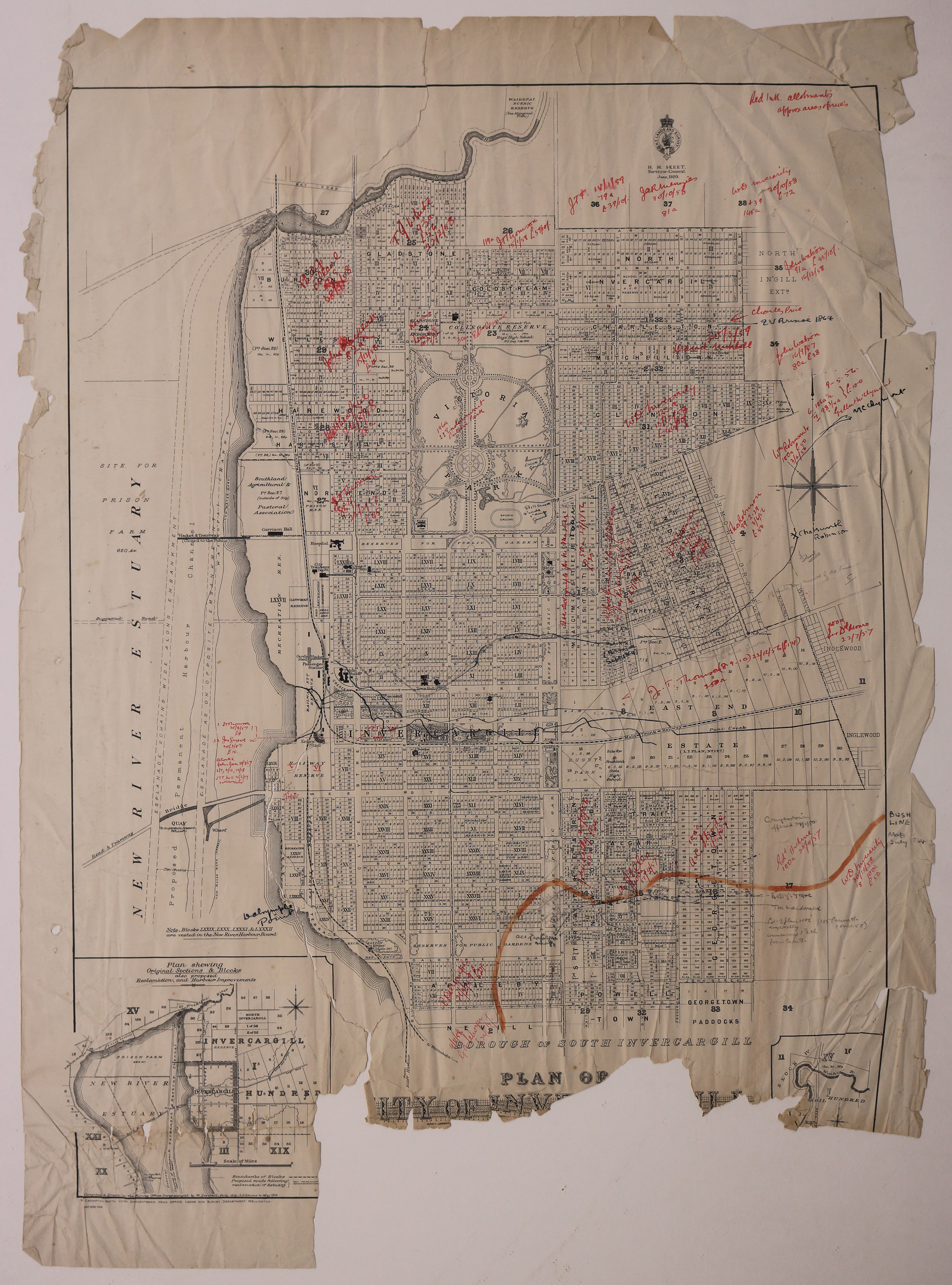
Annotated map of the City of Invercargill.
Existence and Location of Copies
To obtain a high resolution copy of this image please contact the Archive.
Physical Description
Paper. Torn edges and lower portion missing.
Dimensions
H 835mm x W 605mm
Map notes
Compiled and drawn in the Survey Office Invercargill by W. Deverell, July 1912. Additions to May 1916.
H. M. Skeet, Surveyor-General. June, 1920.
Inset map shows original Sections and Blocks, also proposed Reclamation and Harbour Improvements.
Bush line marked in orange. Features land purchasers names handwritten in red ink [with the year, acre and pound amount], as well as other notes in pencil and black ink.
Creator
- Deverell, W. (Draftsman, Person)
Repository Details
Part of the Invercargill City Council Archives Repository
Contact:
50 Dee Street
Private Bag 90111
Invercargill Southland 9810 New Zealand
archives@icc.govt.nz
50 Dee Street
Private Bag 90111
Invercargill Southland 9810 New Zealand
archives@icc.govt.nz
