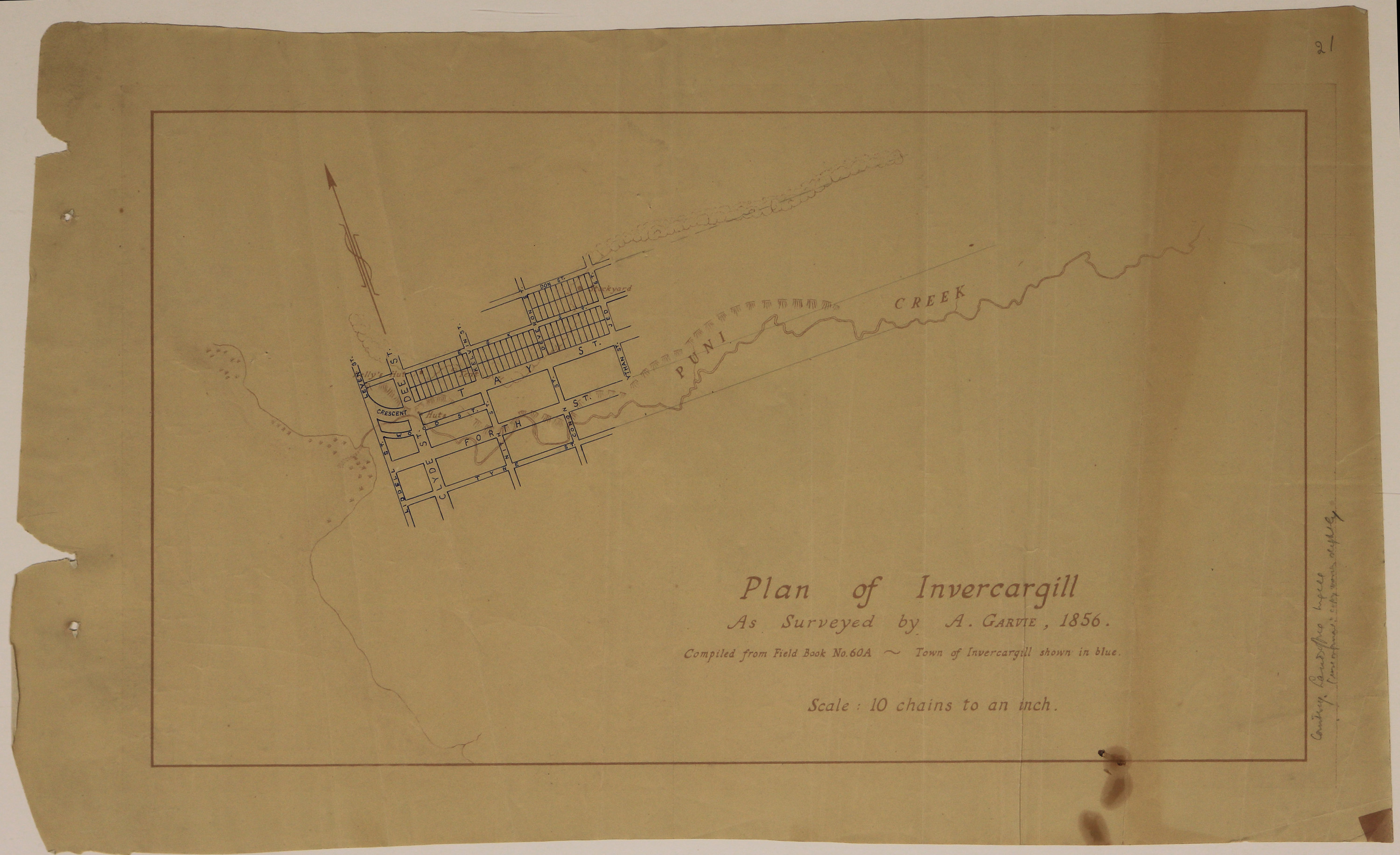
Plan of Invercargill as surveyed by A. Garvie. Compiled from Field Book No. 60A. Town of Invercargill shown in blue., 1856
Component — map-box: 7
Identifier: S00100002_aj
Plan of Invercargill as surveyed by A. Garvie. Compiled from Field Book No. 60A. Town of Invercargill shown in blue.
Scope and Contents
From the Item:
This item contains 85 individual maps.
Dates
- 1856
Conditions Governing Use
This item has no known copyright restrictions. Please acknowledge Invercargill City Libraries and Archives, Ref: A0001 S00100002_aj, when re-using this image.
Biographical / Historical
Alexander Garvie (1820 - 1859) arrived at Port Chalmers in 1848 where he worked as a builder and then trained as a surveyor. He later was an assistant surveyor under John Turnbull Thomson.
Source: The Pioneer Land Surveyors of New Zealand, Part IV by C.A. Lawn, 1977.
Source: The Pioneer Land Surveyors of New Zealand, Part IV by C.A. Lawn, 1977.
Extent
From the Series: 33 maps/plans (Map-Boxes 1 - 8 and Drawer West 6 d)
Language of Materials
English
Overview
Sketch map showing the Puni [Otepuni] Creek and huts, overlayed with blue ink drawing of Invercargill streets.
Existence and Location of Copies
To obtain a high resolution copy of this image please contact the Archive.
Physical Description
Paper. Stains on lower right side. Two holes on left side, as if from binder, and number 21 in pencil top right hand corner.
Dimensions
H 352mm x W 540
Map notes
Pencilled note on right hand side: Courtesy Lands Office, Ingill (use informal: copy (names ?) slightly).
Underlay map details: Puni Creek, Huts, Kelly's Hut, Tent, Stockyard.
Underlay map details: Puni Creek, Huts, Kelly's Hut, Tent, Stockyard.
Repository Details
Part of the Invercargill City Council Archives Repository
Contact:
50 Dee Street
Private Bag 90111
Invercargill Southland 9810 New Zealand
archives@icc.govt.nz
50 Dee Street
Private Bag 90111
Invercargill Southland 9810 New Zealand
archives@icc.govt.nz
