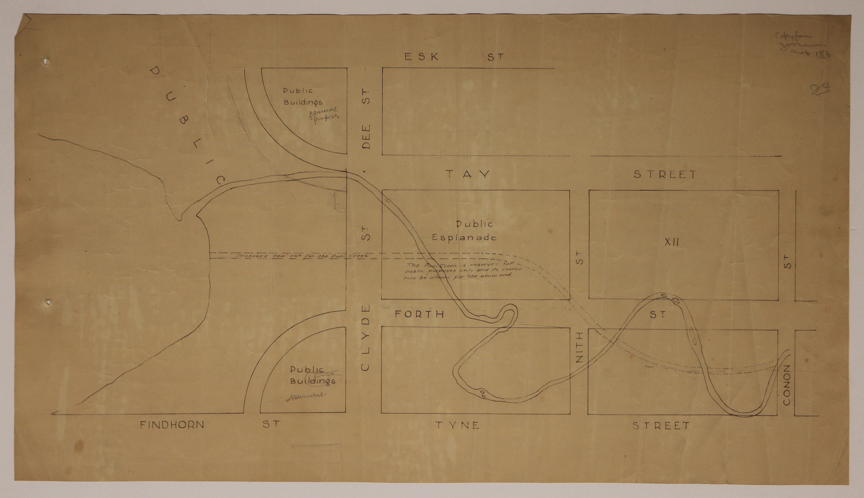
Invercargill map [showing proposed new cut for Otepuni Creek, copied from 1863 map]
Digital Image
Identifier: D00100002_ap
Invercargill map
Dates
- c.1989
Summary
Plan showing the original course of the Otepuni Creek, and the proposed cut. Note in top right corner indicates it was copied from an 1863 JT Thomson map.
Conditions Governing Use
This item has no known copyright restrictions. Please reference Invercargill City Libraries and Archives A0001 S00100002_ap when re-using this image.
Extent
1 digital object : TIFF file.
Existence and Location of Copies
To obtain a high resolution copy of this image please contact the Archive.
Physical Description
Paper.
Dimensions
H 340mm x W 470mm
Repository Details
Part of the Invercargill City Libraries and Archives Repository
