Map of Stewart Island New Zealand
Digital Image
Identifier: D00100001_e
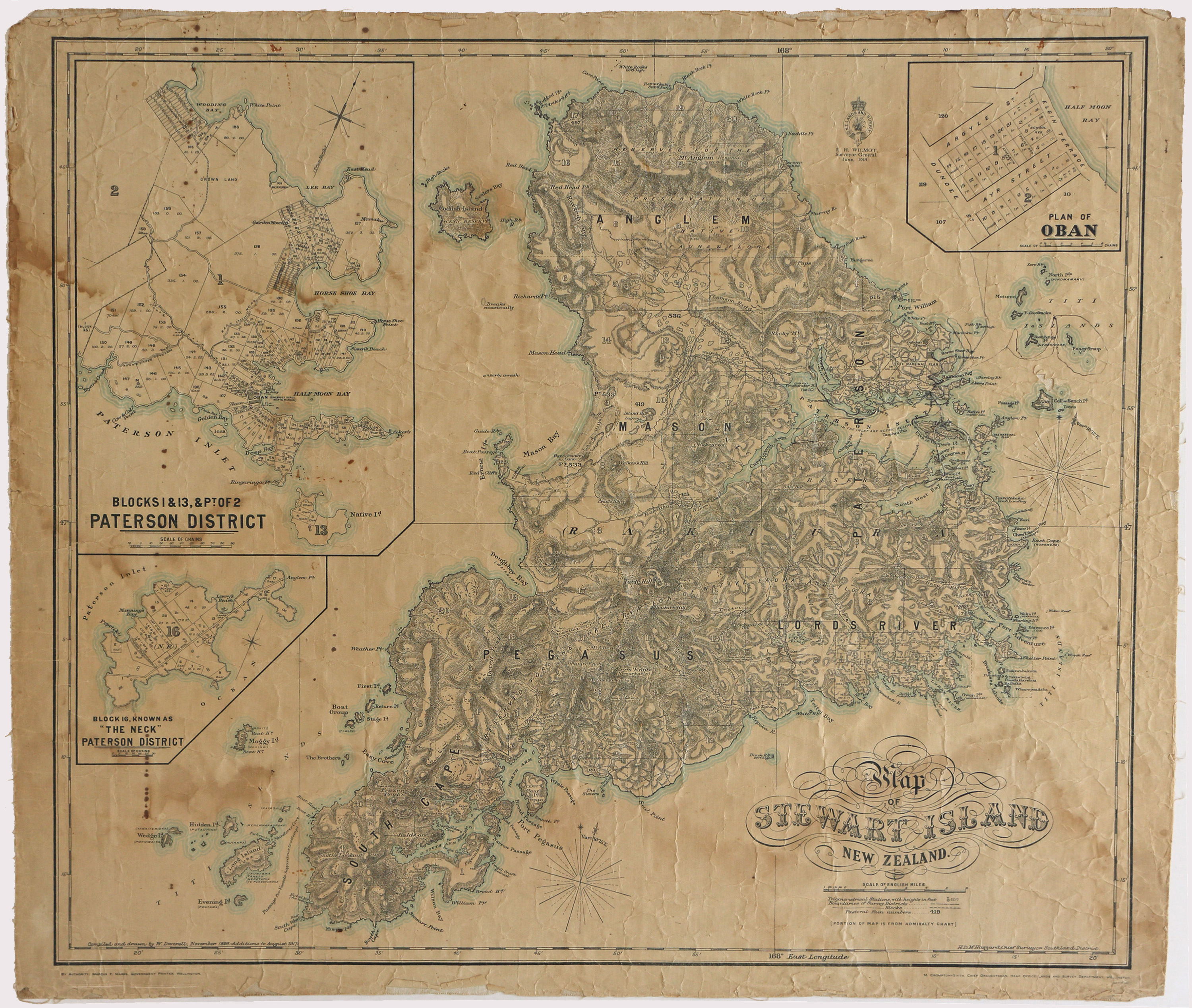
Map of Stewart Island New Zealand
Dates
- November 1898, additions to 1917
- Publication: 1918
Creator
- New Zealand. Department of Lands and Survey (Publisher, Organization)
Summary
Map of Stewart Island New Zealand with insets of Oban and Paterson District.
Conditions Governing Use
This item has no known copyright restrictions. Please reference Invercargill City Libraries and Archives A0001 S00100001_e when re-using this image.
Extent
1 digital object : TIFF file.
Expand All
Existence and Location of Copies
To obtain a high resolution copy of this image please contact the Archive.
Physical Description
Paper on linen.
Dimensions
H 615 mm x W 720mm
Content Notes
H.D.M. Haszard, Chief Surveyor, Southland District. M. Crompton-Smith, Chief Draughtsman, Head Office lands and Survey Department Wellington.
Inset map Plan of Oban, Blocks 1& 13, & Pt of 2 Paterson Inlet, Block 16, known as "The Neck" Paterson District. Pastoral Runs 536, 419, 422 & 533.(538 and 196?)
Inset map Plan of Oban, Blocks 1& 13, & Pt of 2 Paterson Inlet, Block 16, known as "The Neck" Paterson District. Pastoral Runs 536, 419, 422 & 533.(538 and 196?)
Creator
- New Zealand. Department of Lands and Survey (Publisher, Organization)
- Deverell, W. (Cartographer, Person)
Repository Details
Part of the Invercargill City Council Archives Repository
Contact:
50 Dee Street
Private Bag 90111
Invercargill Southland 9810 New Zealand
archives@icc.govt.nz
50 Dee Street
Private Bag 90111
Invercargill Southland 9810 New Zealand
archives@icc.govt.nz
